
Two powerful storms could shift the coastline’s fate.
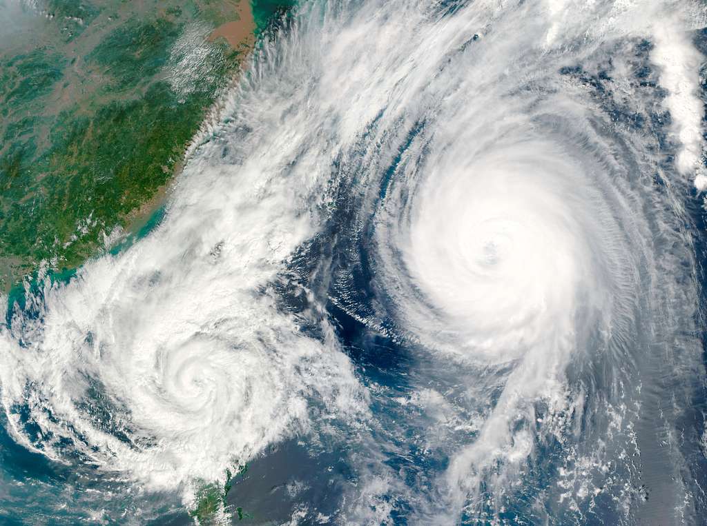
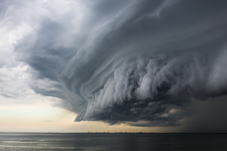
The Atlantic is staging a rare and unsettling act this week. Hurricane Humberto, once a Category 5 powerhouse, is still a sprawling storm system even as it slowly weakens. Not far away, Hurricane Imelda is gaining strength as it climbs northward. Their proximity has meteorologists talking about the Fujiwhara Effect, a phenomenon where two cyclones begin orbiting one another, altering their paths and potentially merging.
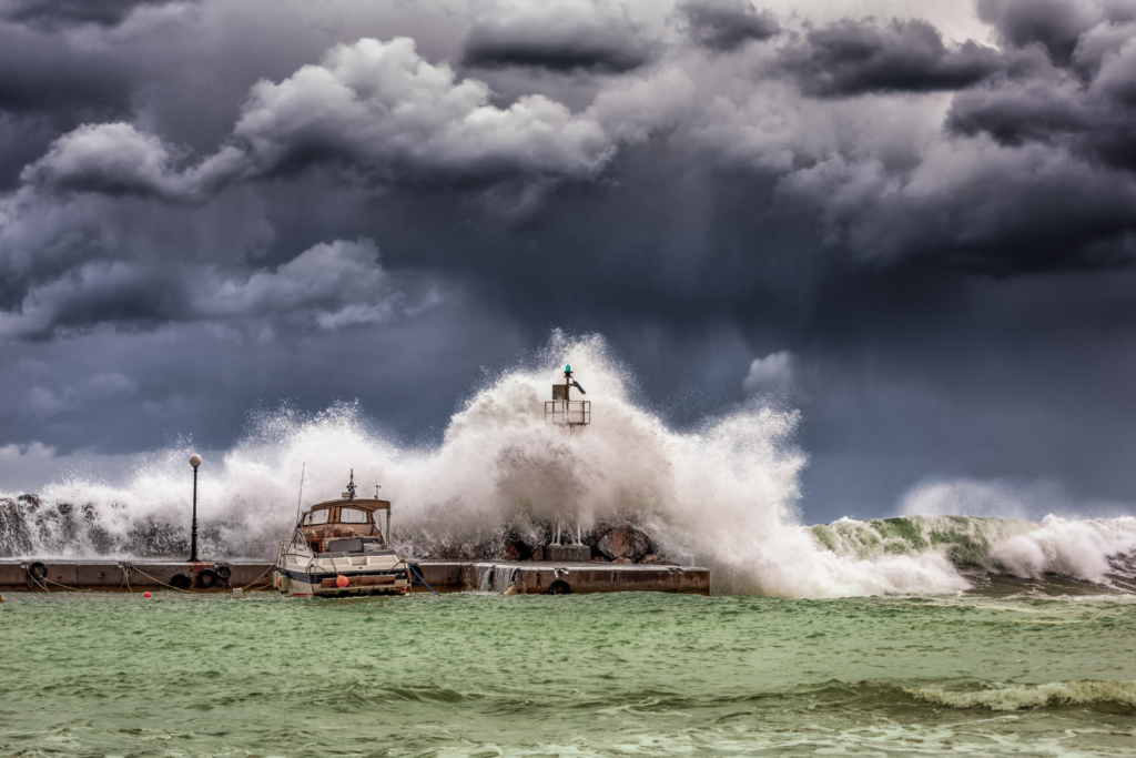
For residents along the Eastern Seaboard, from Florida to the Outer Banks and beyond, the hazards are already showing up. Dangerous rip currents, eroding beaches, and deadly surf have begun long before any storm makes landfall. The next two days may decide whether this unusual dance turns into a coastal crisis or a near miss.
1. Humberto’s reach extends far beyond its center.
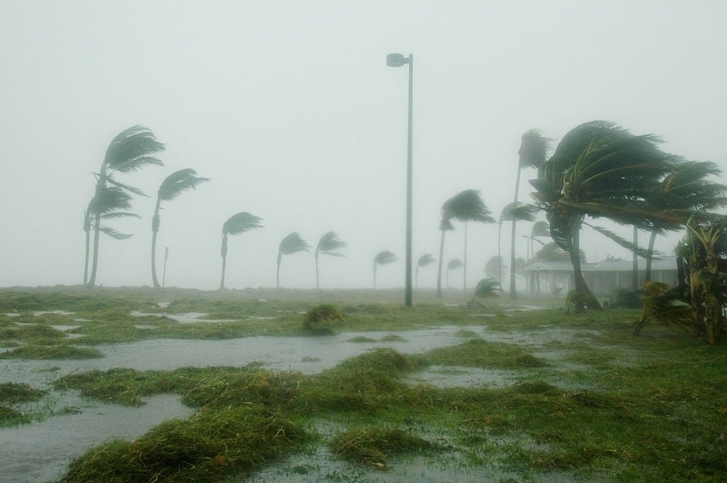
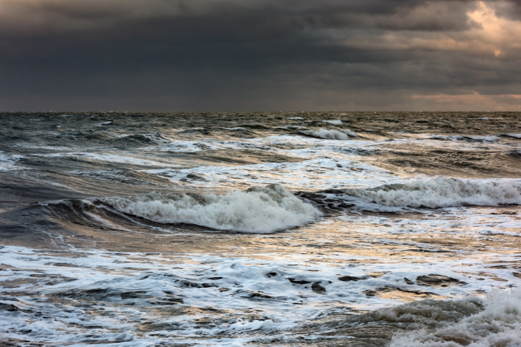
Though Humberto has weakened from its Category 5 peak, its wind field remains broad and punishing. According to the National Hurricane Center, the storm continues to hurl massive waves toward Bermuda and the U.S. East Coast, with swell energy spreading hundreds of miles. Even as the storm’s core drifts offshore, its impact is already visible in Florida and Georgia, where lifeguards are closing beaches in response to rising surf.
Communities understand the paradox: a storm doesn’t need to come ashore to disrupt daily life. Coastal erosion and powerful currents can leave damage that takes months to repair. Humberto’s size makes it impossible to ignore, even as it edges slowly away.
2. Imelda strengthens while sliding north of the Bahamas.
Imelda, now a Category 1 hurricane, has been intensifying as it tracks northward past the Bahamas, as stated by forecasters. Warm waters and favorable winds are fueling its growth, and meteorologists expect it to remain strong as it climbs toward the Carolinas. While a direct strike on Florida is not in the forecast, the storm’s growing reach is already stirring seas and drenching islands in its path.
The concern lies in how Imelda interacts with Humberto. If drawn into the larger system, its trajectory could shift, altering which states see the worst impacts. For residents along the Eastern Seaboard, that uncertainty is driving heightened caution.
3. A rare cyclone dance complicates the forecast.

Meteorologists are watching closely for signs of the Fujiwhara Effect, reported by LiveScience, which occurs when two storms orbit one another like dancers around a central point. If it happens, the stronger storm, likely Humberto, could pull the weaker one into its circulation. Such interactions are rare in the Atlantic, making this a closely studied moment for forecasters.
The stakes are high because even a subtle shift in the storms’ rotation could change the surf, rainfall, and flooding outlook from Florida up through the Carolinas. Forecast models show a wide spread of possibilities, fueling both curiosity and unease.
4. Florida beaches are already feeling the strain.
In Florida, waves are pounding the Atlantic shoreline with an intensity unusual for storms so far offshore. Volusia and Brevard counties have posted rip current warnings, while lifeguards warn swimmers that even experienced surfers may struggle in the unpredictable waters. Residents near barrier islands are watching dune lines erode with each high tide.
Local officials are taking no chances, staging crews to monitor vulnerable roadways and boardwalks. This early damage comes as a sobering reminder that the state doesn’t need a direct hurricane strike to rack up costly consequences.
5. Tragedy strikes with a fatal rip current.
On Tuesday, a 51-year-old man drowned after being swept out by a rip current near Daytona Beach. Authorities linked the deadly currents to Humberto and Imelda’s overlapping swell patterns, which have intensified water hazards along Florida’s coast. The death underscores the reality that the ocean itself is often the first killer in a hurricane season, long before winds reach shore.
For families nearby, the loss is a painful signal that warnings are not abstractions. Beaches look deceptively calm from a distance, but the unseen pull of water remains relentless.
6. North Carolina’s Outer Banks see homes collapse.
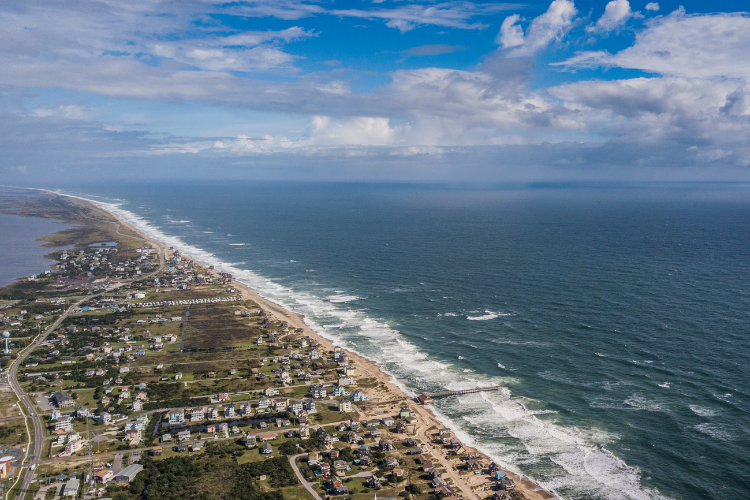
While Florida manages currents, North Carolina has seen houses fall into the sea. Six unoccupied homes in Buxton collapsed this week as Humberto and Imelda churned offshore. Years of coastal erosion left the structures vulnerable, and the storm surge and heavy surf finally tipped them into the Atlantic. No injuries were reported, but images of the collapses traveled quickly across national media.
Officials with the Cape Hatteras National Seashore have closed surrounding beaches to manage debris cleanup. It’s a stark example of how storms amplify existing fragility in places where sand and sea are already in uneasy balance.
7. Emergency managers keep the coast on alert.
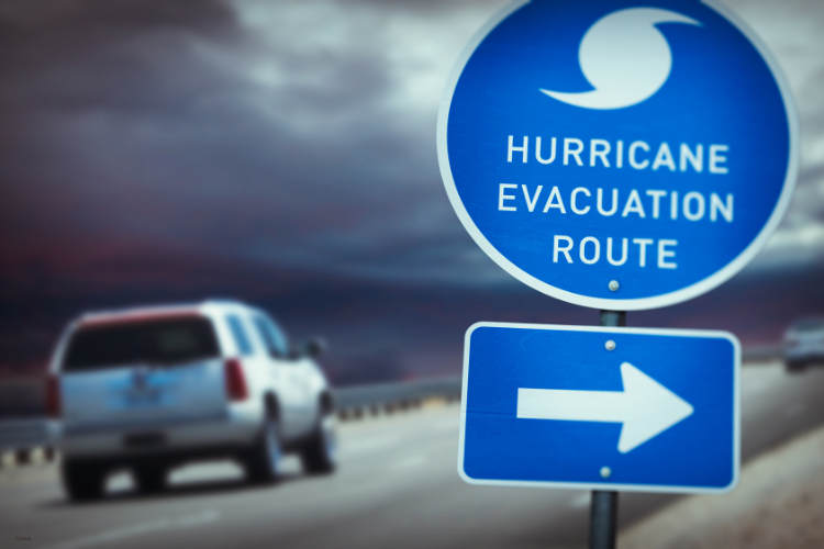
Florida, Georgia, and the Carolinas are coordinating closely with FEMA and the National Hurricane Center. Shelters aren’t open, and evacuations aren’t called yet, but preparations are quietly underway. Coastal counties are checking generators, updating flood maps, and rehearsing evacuation routes. The atmosphere is one of readiness, not panic.
Officials stress that the uncertainty of two storms interacting demands flexibility. The Fujiwhara Effect, if it unfolds fully, could shift conditions rapidly. Emergency managers must be ready to make last-minute calls.
8. Satellite and reconnaissance flights provide vital clues.
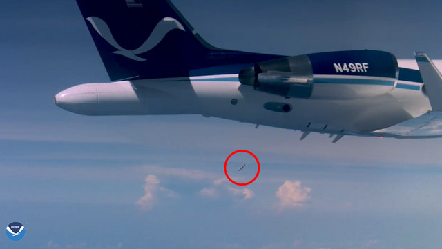
To pin down the storms’ paths, scientists are sending reconnaissance aircraft into Humberto and Imelda. Crews deploy dropsondes, small instruments that measure pressure, humidity, and winds as they fall, to refine forecasts. Satellite imagery shows swirling cloud tops while ocean buoys record wave heights and surface temperatures.
These details matter. Every new piece of data helps forecasters simulate whether the two storms will remain separate or drift into a spiraling embrace. Without these real-time measurements, the margin of error would be far greater.
9. Beyond Florida, the Carolinas brace for impact.
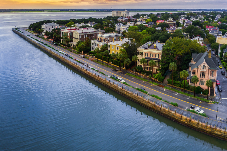
Communities along the Carolinas are taking storm preparations seriously. The Outer Banks, Wilmington, and Charleston face direct exposure to Humberto and Imelda’s surf and rain. Emergency managers in North Carolina have issued beach hazard warnings, urging residents to avoid walking on piers or wading near the waterline. For towns whose economies rely on tourism, these storms arrive at a fragile time, threatening infrastructure and livelihoods alike.
Georgia’s coastal counties are also monitoring tides closely. Even minor flooding can swamp historic districts in Savannah and low-lying marshlands just inland.
10. The next two days will determine the outcome.

Forecast tracks show a critical 48-hour window where Humberto and Imelda may draw closer, drift apart, or partially merge. By the end of the week, meteorologists expect a clearer picture of whether the storms will continue separately or interact fully. That distinction will decide whether Florida remains mostly battered by surf, or if the Carolinas see worsening rain and surge.
For residents along the Eastern Seaboard, patience and vigilance are now the watchwords. Every update carries weight, and each tide cycle brings a reminder that the coast is always vulnerable to what brews far out at sea.