
New radar eyes will change everything.
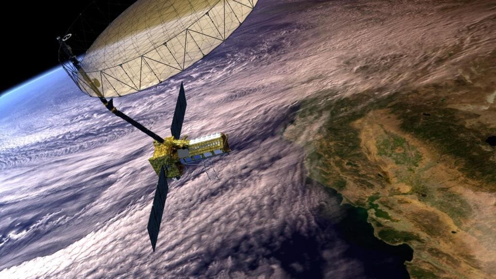
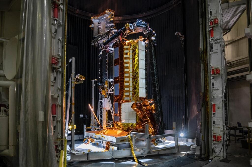
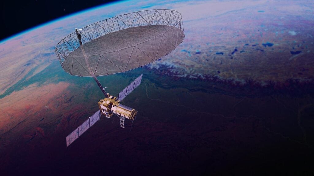
In July 2025, NASA and India launched NISAR, a synthetic aperture radar satellite built to peer through clouds, darkness, and thick vegetation to observe Earth’s shifting surface. It’s the most advanced radar mission ever sent to orbit, designed to measure movement and deformation across land, ice, and water with astonishing precision.
The data coming in is already rewriting what we know about our planet. From ice sheets creeping in silence to cities slowly sinking, NISAR’s global eye will soon reveal things that have always been hidden in plain sight.
1. It will detect land shifts as small as a centimetre.
NISAR’s twin radar systems, NASA’s L-band and ISRO’s S-band, are calibrated to measure surface motion with centimetre-scale accuracy. That means the satellite can catch ground deformation invisible to traditional mapping, revealing the earliest hints of landslides, sinkholes, or subsidence long before they become disasters. As stated by NASA, these radar measurements can track changes smaller than the width of a fingernail.
Each time the satellite revisits a location, it compares radar signals to detect any subtle change in the surface. Over time, these patterns form a moving timeline of Earth’s quiet shifts, providing scientists a way to predict structural collapse, fault strain, and even slow-burn disasters in real time.
2. Hidden fault lines could soon be visible from space.
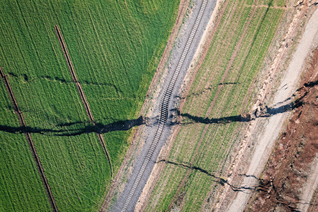
Because even deep tectonic stress can cause tiny shifts at the surface, NISAR will help uncover previously unknown faults and monitor how stress redistributes after major quakes. This could be a turning point for earthquake forecasting, as researchers begin identifying regions under silent strain that don’t yet show visible cracking. The ability to see these movements months in advance could help refine hazard maps for vulnerable cities.
As reported by the Indian Space Research Organisation, the mission’s S-band radar was specifically engineered to detect fine crustal motion and deformation in seismic zones. This means NISAR could expose new active faults in regions thought to be geologically stable, providing an early glimpse of potential quake risks.
3. Glaciers and ice sheets will finally be tracked precisely.
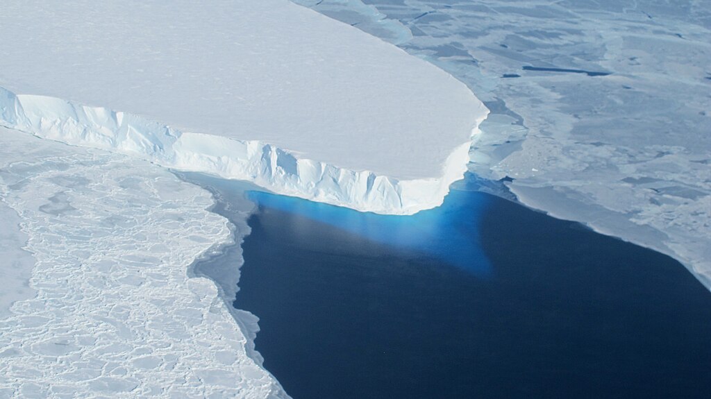
One of NISAR’s key objectives is to watch the cryosphere—the frozen parts of Earth that regulate global sea levels. The satellite’s radar can track how ice flows and melts across seasons, revealing where glaciers are thinning or accelerating their slide toward the ocean. According to the National Snow and Ice Data Center, radar imaging like this allows scientists to see through snow and detect changes even during polar night when sunlight vanishes for months.
By returning to the same spots every 12 days, NISAR captures the evolving story of melt, refreeze, and retreat. This could refine our understanding of sea-level rise, showing where meltwater is forming under the ice and how warming oceans are eroding glacier fronts from below.
4. Groundwater loss beneath major cities will be exposed.

Radar may not sound like a tool for measuring water, but it can spot when land sinks because aquifers beneath are being drained. When cities pump too much groundwater, the soil compacts and the surface slowly drops—a process called subsidence. NISAR’s precision will let scientists pinpoint these hotspots and connect them with water overuse, cracked infrastructure, and flooding risk.
Urban planners could use these data to regulate water extraction and manage aquifers more sustainably. The satellite’s ability to cover entire regions at once will also reveal the hidden water crises unfolding under rapidly growing cities in Asia, Africa, and Latin America.
5. Forest decline will be mapped in striking 3D detail.
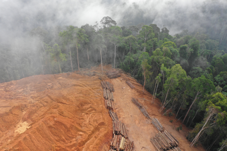
Unlike optical satellites that only see the tops of trees, radar can penetrate forest canopies to detect structure and density. NISAR’s radar returns can distinguish between healthy biomass and degraded vegetation, allowing scientists to measure forest loss before it becomes visible. It’s an early alert system for deforestation and habitat decline.
Tracking canopy collapse or regrowth over time will help conservationists monitor illegal logging, land conversion, and climate-driven dieback. This three-dimensional data could become one of the strongest tools for measuring how carbon is stored—or lost—across the planet’s forests.
6. Wetlands and soil moisture will be monitored in real time.
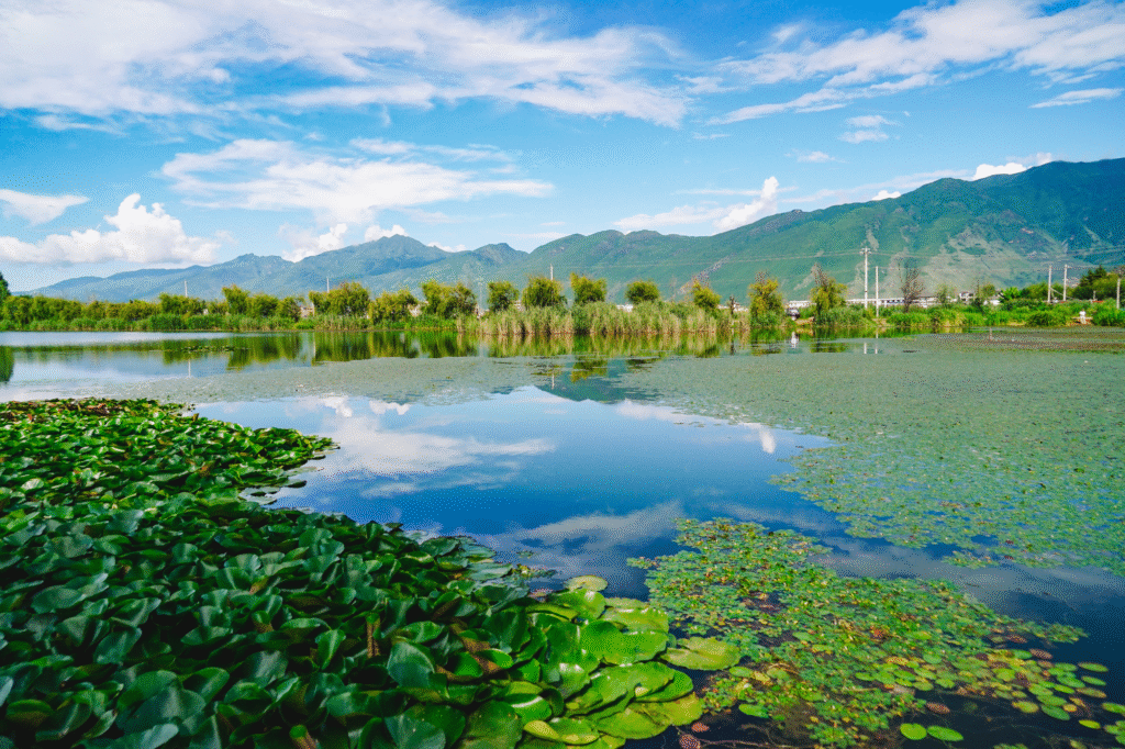
Wetlands are Earth’s natural filters, but many are vanishing. NISAR can monitor how they breathe—expanding during rainy seasons, contracting in drought, and shifting with rising temperatures. Because radar responds to moisture, it can reveal these fluctuations even when cloud cover blocks traditional satellites.
Scientists will finally see how fast wetlands recover from storms, how drought reshapes river deltas, and where floodplains are shrinking due to human development. This knowledge could help restore ecosystems before they reach a tipping point.
7. Subtle strain in infrastructure could be detected early.
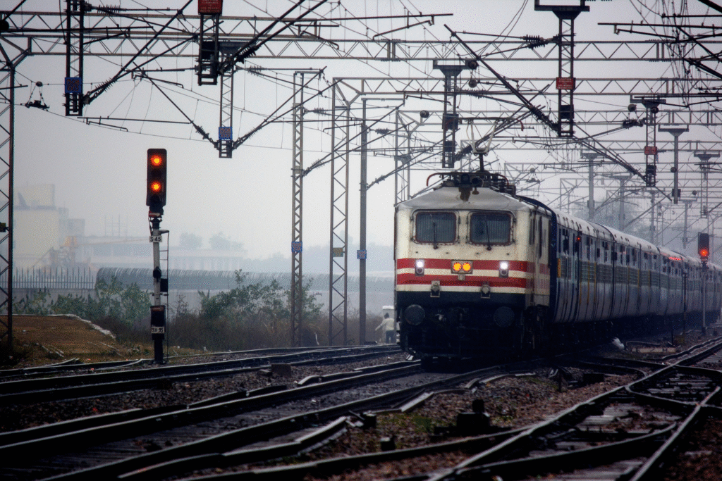
Bridges, railways, and pipelines all bear subtle motion under stress. NISAR will detect those millimetre-level shifts, exposing places where soil compression or structural fatigue is taking hold. For civil engineers, this data could become an early-warning map for infrastructure failure.
If a bridge begins to sag or a dam shows slight warping, radar imagery can flag it months before a visible crack forms. Cities could use this insight to prioritize inspections and avoid costly disasters.
8. It will chart coastal erosion and land loss.
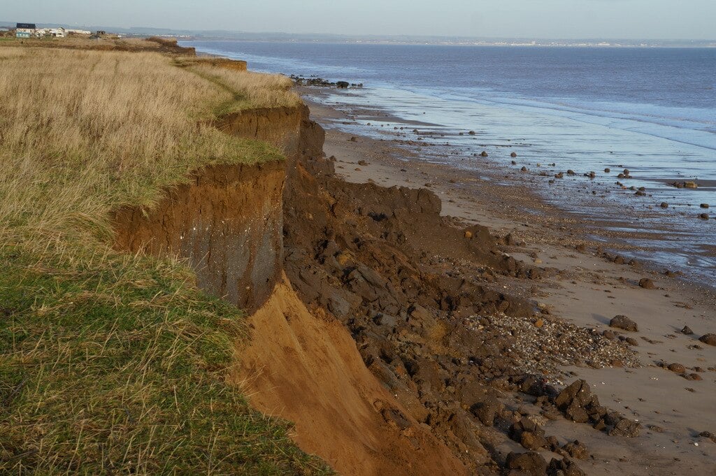
NISAR’s radar sees through clouds and storms, making it perfect for tracking coastlines battered by waves or rising seas. Each pass builds a precise contour of land boundaries, showing where beaches retreat or marshlands vanish after major storms.
This data could identify which communities are losing land fastest and where protective barriers are failing. As coastal populations grow, these radar-based warnings could shape how cities plan for sea-level adaptation and disaster resilience.
9. Volcanoes will reveal their movements before they erupt.
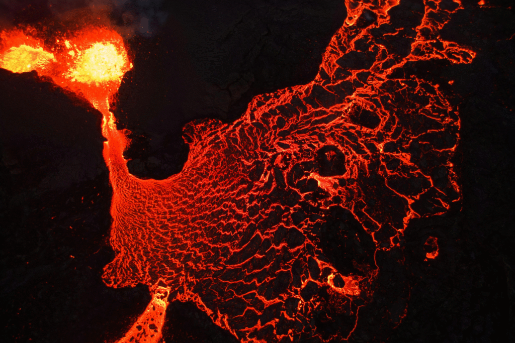
Even when a volcano looks quiet, its surface can swell as magma builds beneath. NISAR will pick up those bulges and deflations, allowing scientists to watch eruptions form in slow motion. That’s vital for regions where volcanoes lie close to populated areas but lack extensive ground monitoring.
Combined with gas and thermal sensors, these radar readings will refine eruption forecasts, providing a better sense of timing and intensity. It’s a new way to listen to volcanoes breathing beneath the crust.
10. Global access to open radar data will redefine science.
NISAR’s mission design includes near-real-time data sharing with open access for researchers worldwide. That means anyone—from students to national space agencies—can analyze radar imagery to study climate, water, or land changes.
This transparency could democratize environmental science, allowing smaller nations and local scientists to act on data that was once locked behind government walls. The planet’s subtle movements will no longer be secret—they’ll be part of a shared global story written in radar waves.