
Scientists warn several regions face massive risk.
Across the United States a handful of seismic zones are drawing intense attention from researchers who track the quiet shifts beneath our feet. These regions sit over faults capable of producing quakes far stronger than the everyday tremors people occasionally feel. Their histories reveal long intervals of silence followed by destructive bursts that reshape entire landscapes. As scientists map these dangerous zones with new tools, the urgency around future risk grows sharper, and the states lying above them face questions they can no longer ignore.
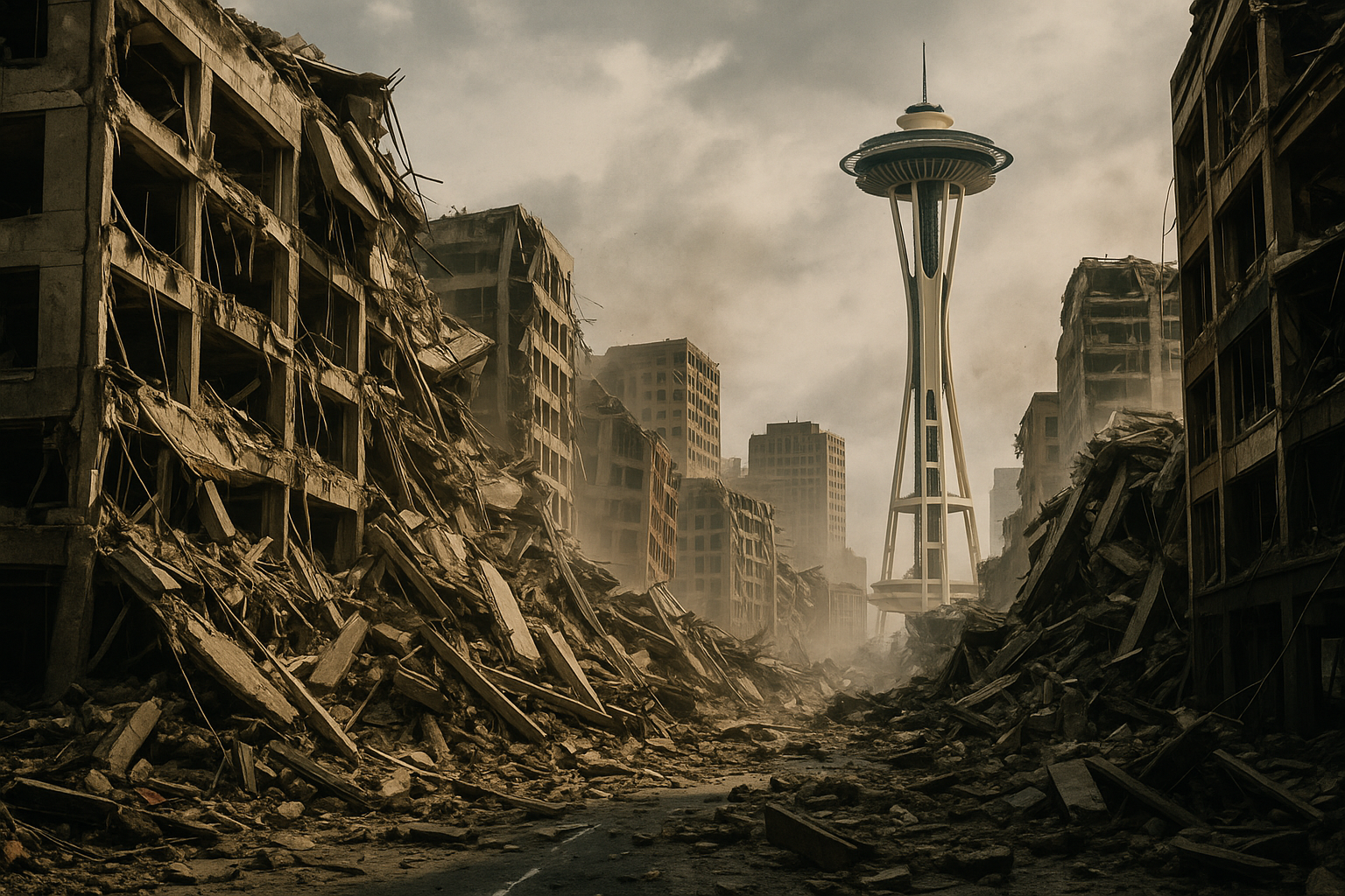
1. The Pacific Northwest carries the weight of Cascadia danger.
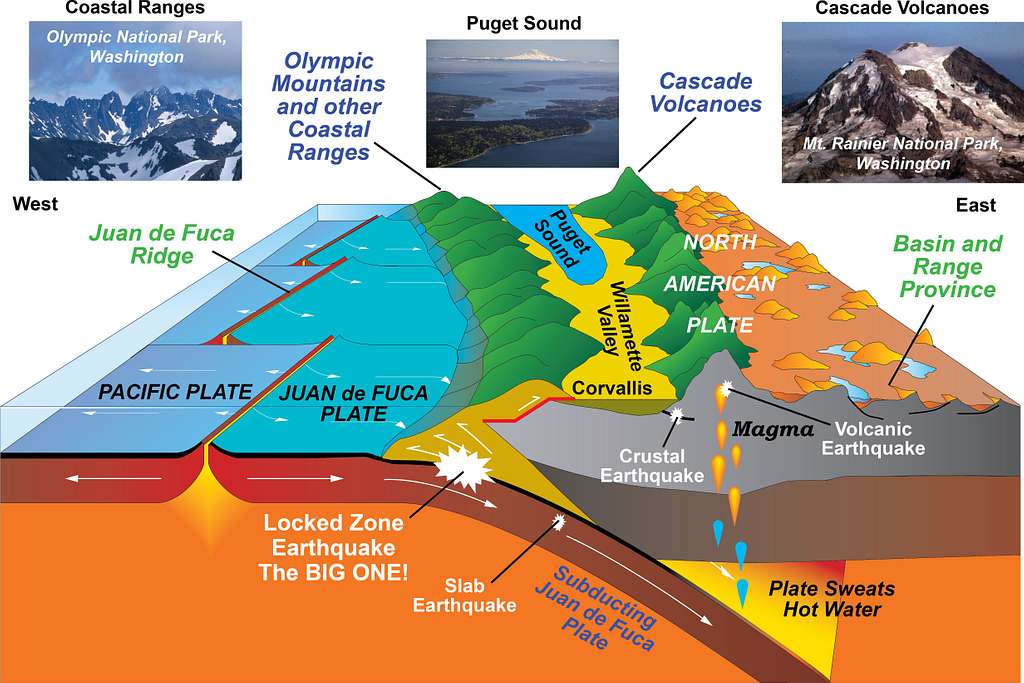
Deep offshore lies the Cascadia Subduction Zone, a fault capable of producing a magnitude nine earthquake. According to the United States Geological Survey, this region has generated catastrophic events roughly every few centuries, the last occurring in the year 1700. That silence has allowed pressure to accumulate in ways scientists track with growing concern.
Communities in Washington and Oregon sit directly in the impact zone. A rupture here would shake coastlines violently and unleash a massive tsunami along low lying areas. The knowledge pushes officials and residents to prepare for a future event whose timing remains uncertain yet unavoidable.
2. California remains vulnerable along its most famous fault line.
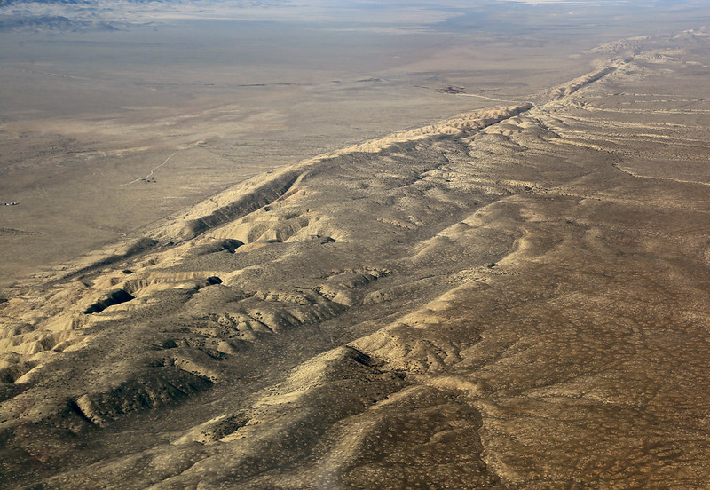
Scientists monitor the San Andreas Fault closely because it stores enormous seismic energy along several major segments. As stated by Smithsonian Magazine, parts of the southern section have not seen a major rupture since the eighteenth century, suggesting strain continues to build across the region. This accumulation places cities such as Los Angeles within potential reach of a large future quake.
Residents know the region’s past, yet awareness does not erase risk. Decades of development atop unstable ground create layers of vulnerability. The tension beneath California grows quietly, setting the stage for a powerful release that experts say could reshape infrastructure across vast areas.
3. Central states face hidden risk in the New Madrid zone.
The New Madrid Seismic Zone stretches beneath Missouri, Arkansas and Tennessee and produced a series of massive quakes in the early nineteenth century. As reported by FEMA, those events were strong enough to alter the Mississippi River’s course and damage settlements far beyond the epicenters. Modern analysis suggests the fault remains active, though unpredictable.
Its location troubles scientists because infrastructure in the region was not designed for large seismic shocks. Should another powerful rupture strike, states across the Mississippi Valley could experience shaking far stronger than anything in recent memory. The possibility drives ongoing efforts to reassess building standards.
4. Utah’s Wasatch Front holds a deeply concerning fault system.
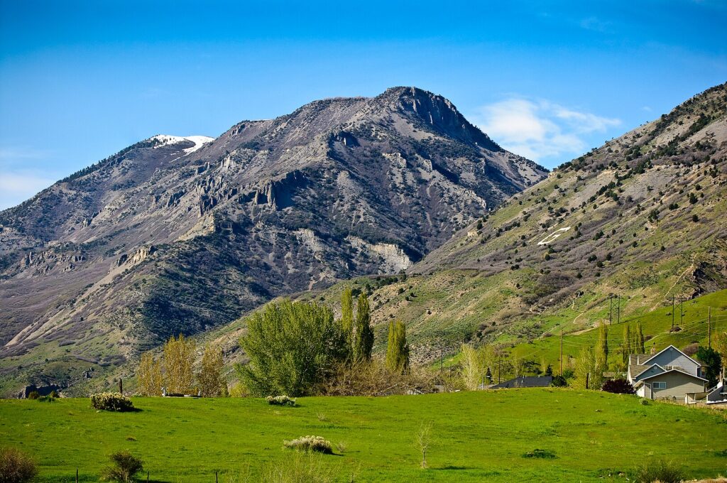
Running beneath a densely populated corridor, the Wasatch Fault has produced large quakes repeatedly throughout geologic time. Its long quiet interval hints at built up pressure. Geologists studying trench layers found evidence of past events that lifted and dropped land surfaces in sudden dramatic shifts.
Salt Lake City sits directly above vulnerable ground. A major rupture here would threaten homes, transportation networks and critical water systems. The rapid growth of communities along the fault only intensifies the concern as more people settle into areas that scientists say could be severely shaken.
5. Alaska faces massive seismic power stored beneath rugged terrain.
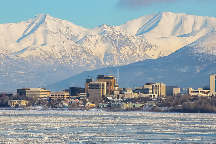
The state experiences more earthquakes than any other in the country, including some among the strongest ever recorded. Subduction forces beneath southern Alaska generate pressure that releases in sudden violent ruptures capable of affecting both remote regions and major ports.
Anchorage has withstood powerful quakes before, yet the potential for another large event always looms. The landscape itself tells the story through uplifted coastlines and fractured mountains that preserve the memory of past seismic upheaval. Each shift reminds researchers that Alaska’s faults still carry tremendous energy.
6. South Carolina hides a surprising fault beneath coastal plains.
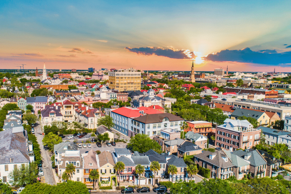
Charleston remains one of the most seismically active areas in the eastern United States due to a complex network of faults buried beneath its coastal soils. The city experienced a devastating earthquake in 1886, and studies show the underlying structures continue to move slowly.
The region’s modern development increases the stakes. Soft sediments beneath many neighborhoods amplify shaking, raising concern among engineers who model potential outcomes. Though quieter compared to western faults, the risk persists and underscores how seismic danger is not confined to one region of the country.
7. The Intermountain West reveals strain stretching from Nevada to Wyoming.
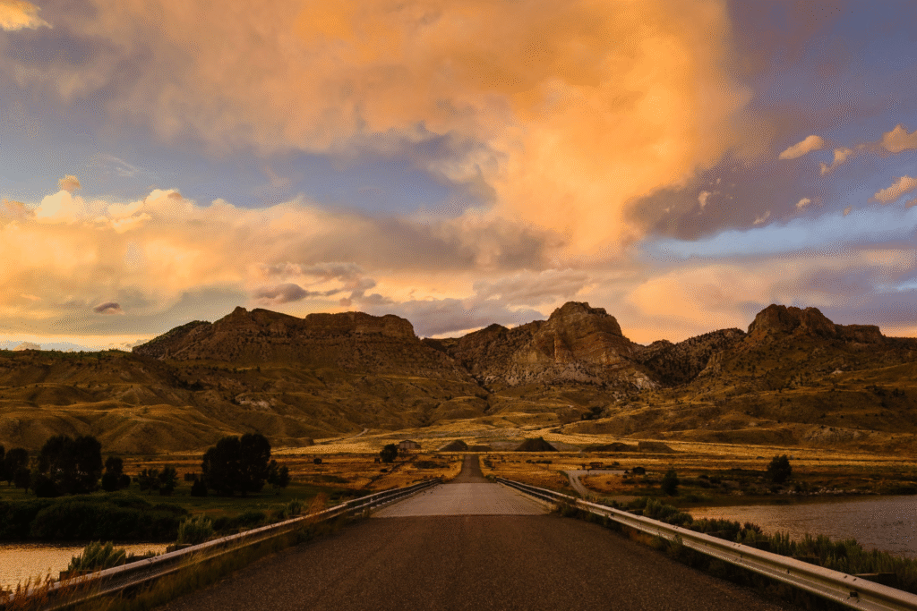
Geologists have mapped a wide zone of extensional forces that tear the crust apart across several western states. This stretching creates numerous active faults that periodically release energy in damaging quakes. Communities spread across the region face varying degrees of exposure depending on local geology.
These scattered faults make prediction difficult, leaving officials to prepare broadly rather than focus on one central threat. The landscape bears scars from past ruptures, offering clues about how future events might unfold across wide swaths of terrain.
8. Oklahoma’s induced seismicity reshaped understanding of human linked quakes.
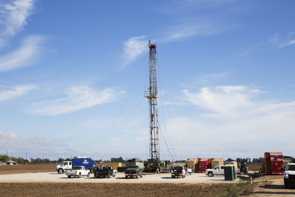
In recent years Oklahoma experienced a dramatic rise in earthquake activity connected to deep wastewater injection practices. Though regulations have reduced the number of events, certain faults remain sensitive to stress changes introduced by underground pressure.
Communities that rarely thought about earthquakes saw roads crack and homes shake, revealing how even modest faults can awaken under shifted stress. The episode remains a reminder that seismic risk can change quickly when human activity alters conditions underground.
9. Hawaii’s volcanic systems drive intense yet unique seismic threats.
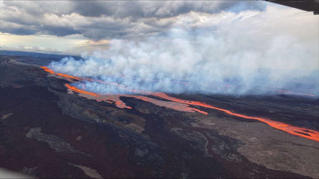
Beneath the islands, magma movement creates frequent seismic activity, some of which can reach damaging intensity. As lava chambers fill or drain, pressure changes trigger earthquakes capable of shifting land, breaking roads and damaging structures.
Big Island residents know the constant rhythm of small quakes, but the region’s volcanic nature means sudden changes can escalate risk rapidly. The connection between seismic and volcanic systems creates an unpredictable environment that demands constant monitoring.
10. Preparing now may determine outcomes for millions nationwide.

Across all these states one truth remains clear. The next large quake, wherever it occurs, will test infrastructure, emergency systems and community resilience. Modern tools reveal how pressure builds silently beneath our feet, waiting for a moment to release energy that could transform entire landscapes.
Preparation becomes a shared responsibility. As states improve codes and strengthen response plans, they create a future where fewer lives hang in the balance. The stakes grow with every quiet year that passes, reminding everyone that the ground beneath them is never fully still.