
The lost metropolis that reshaped North America’s past.
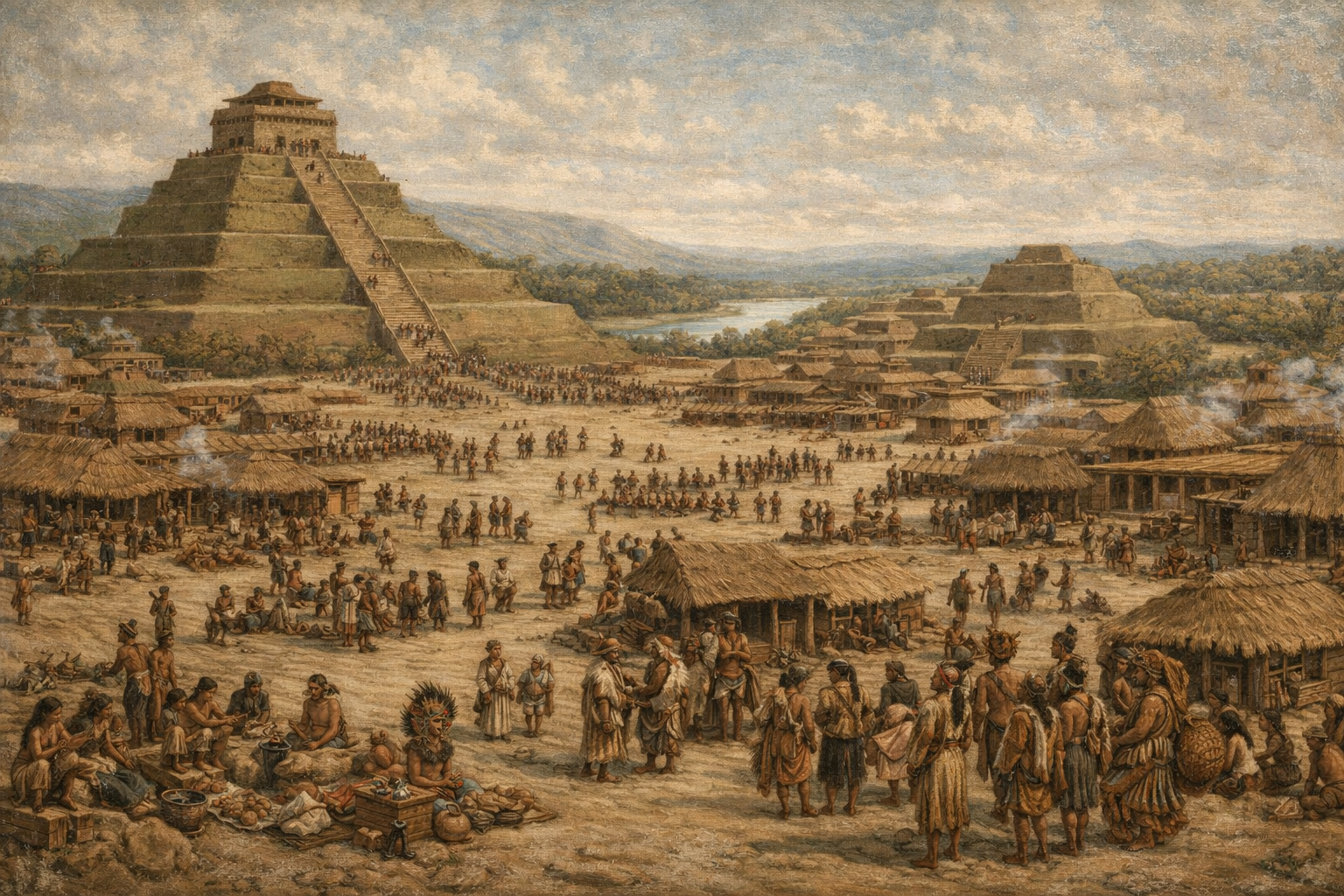
For centuries, fields across the American Bottom hid a metropolis. Near today’s Collinsville, Illinois, earthen mounds once anchored Cahokia, the largest city north of Mesoamerica. At its height around 1050 CE, tens of thousands lived along the Mississippi’s floodplain, trading copper, shell, and ideas. New analyses sharpen dates, scale, and organization, revealing a planned urban center that rivaled medieval capitals while leaving no written record behind. Archaeology now reconstructs daily life, governance, and environmental pressures with surprising clarity today still.
1. The city rose fast during a warm century.
Population estimates now converge near forty thousand residents by 1100 CE, concentrated around Monks Mound. Excavations show neighborhoods, plazas, and causeways laid out rapidly as maize yields climbed during the Medieval Warm Period. Growth appears intentional rather than accidental, suggesting coordinated leadership and labor mobilization on an unprecedented scale locally.
Settlement density and construction timing align across the floodplain, pointing to synchronized planning, as reported by Smithsonian Magazine. Such speed required stored surplus, predictable seasons, and shared belief systems. The pattern challenges older views of slow village aggregation and reframes Cahokia as an early experiment in true urbanism regionally important.
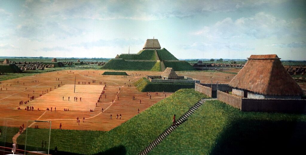
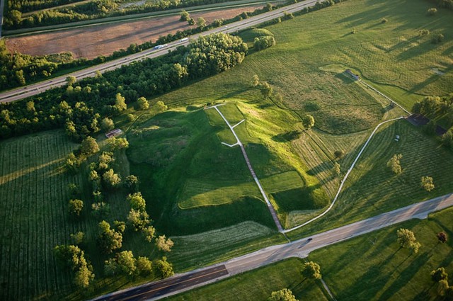
2. Monks Mound anchored power at the city center.
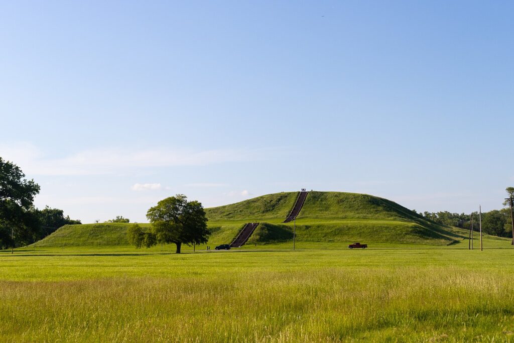
Monks Mound towers thirty meters high, covering more ground than the Great Pyramid’s base. Its stepped terraces supported elite buildings aligned to solstices, indicating cosmology fused with authority. Construction layers reveal repeated rebuilding, implying long term rule rather than brief dominance over surrounding communities across the American Bottom region systematically.
Ramps and borrow pits show organized logistics, while nearby plazas framed ceremonies and councils. The mound’s orientation mirrors solar events documented across Mississippian sites, suggesting shared knowledge networks, as stated by National Geographic. These alignments reinforced legitimacy through predictable celestial calendars used for governance and agricultural scheduling across seasons annually.
3. Trade routes tied Cahokia to distant worlds.
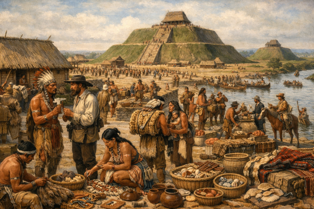
Artifacts trace connections reaching the Great Lakes, Gulf Coast, and Appalachians. Copper, marine shell, mica, and chert arrived in quantities beyond household exchange. Workshops near plazas standardized forms, implying managed distribution and ritual value embedded within everyday objects moving along river corridors and overland portages efficiently for generations of traders.
Isotopic studies link materials to specific sources, clarifying reach and frequency, as discovered by Encyclopaedia Britannica. Such scale required trust, schedules, and shared standards, tying economy to ideology. Cahokia functioned as a broker city, translating distant resources into local power through rituals, feasts, and public works that structured civic life.
4. Woodhenge tracked time for farming and ceremony.
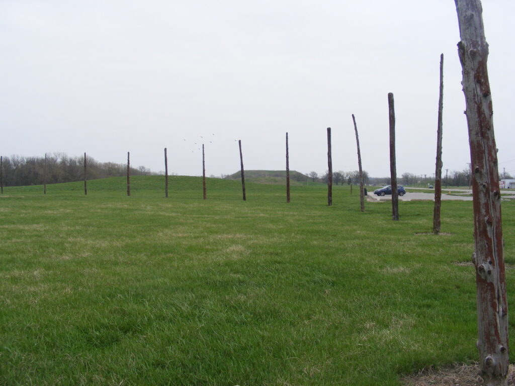
Timber circles erected west of Monks Mound aligned with sunrise positions across seasons. Posts marked solstices and equinoxes, coordinating planting and harvest. Rebuilt multiple times, Woodhenge reflects sustained observation and communal agreement about calendars essential to floodplain agriculture under variable river conditions and shifting climate patterns recognized by residents collectively.
Precision mattered because timing failure risked famine. Alignments also staged public rituals, binding households to shared schedules and leaders. By linking sky watching with food security, Cahokians fused science and belief into practical governance that endured for centuries despite floods, droughts, and political change across generations within the valley system.
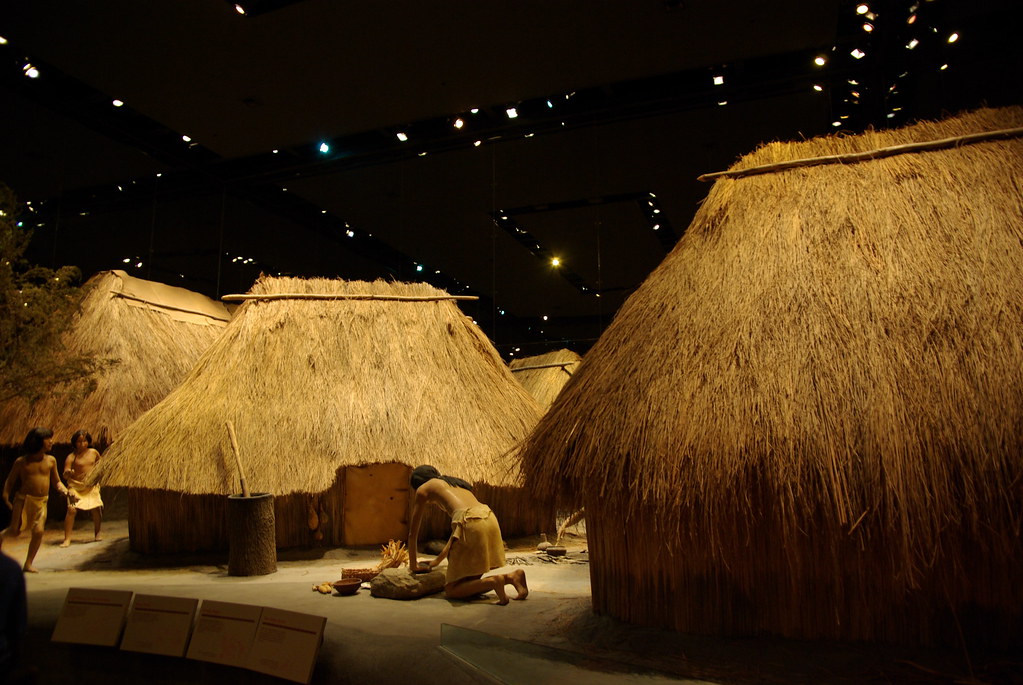
5. Neighborhoods revealed social order without stone walls.

House clusters varied in size and goods, signaling status differences. Elite precincts sat near plazas, while craft areas concentrated production. Cemeteries show differential burial treatment, indicating hierarchy expressed through space rather than fortifications or written laws visible daily through movement, access, and ceremony patterns recognized by residents themselves over time.
Yet neighborhoods shared standardized layouts and materials, suggesting common norms. Streets and paths channeled gatherings toward plazas, reinforcing cohesion. Social differences existed, but integration mattered, allowing rapid mobilization for building, feasting, and defense during crises such as floods, shortages, or external conflict without fragmenting the urban whole under shared leadership.
6. The river shaped food, trade, and risk.
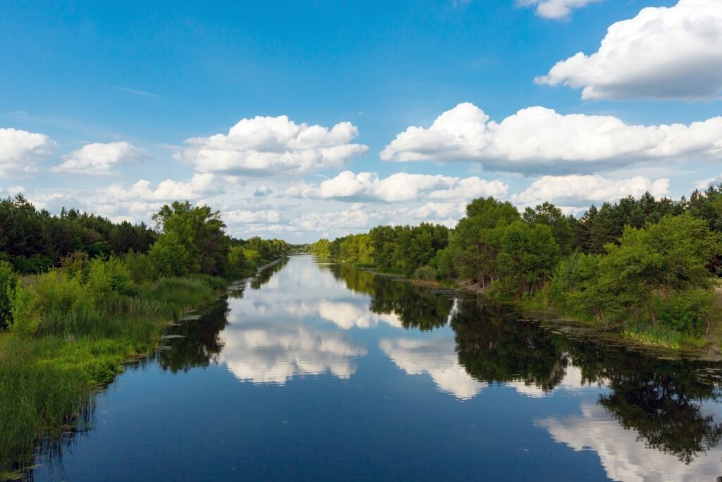
The Mississippi and its tributaries supplied fish, waterfowl, and fertile soils. Flood cycles refreshed fields yet threatened homes, demanding elevated platforms and seasonal planning. Proximity enabled canoe transport, knitting markets while exposing residents to environmental volatility that leaders managed through storage and relocation strategies tested repeatedly across decades of occupation.
Archaeobotany shows maize dominance complemented by squash and beans. Surpluses buffered bad years and fed workers. Control of granaries likely underpinned authority, turning river uncertainty into leverage for organizing labor and ritual obligations within a dense population dependent on seasonal predictability and collective trust in management systems built locally there.
7. Religious imagery unified diverse peoples and clans.
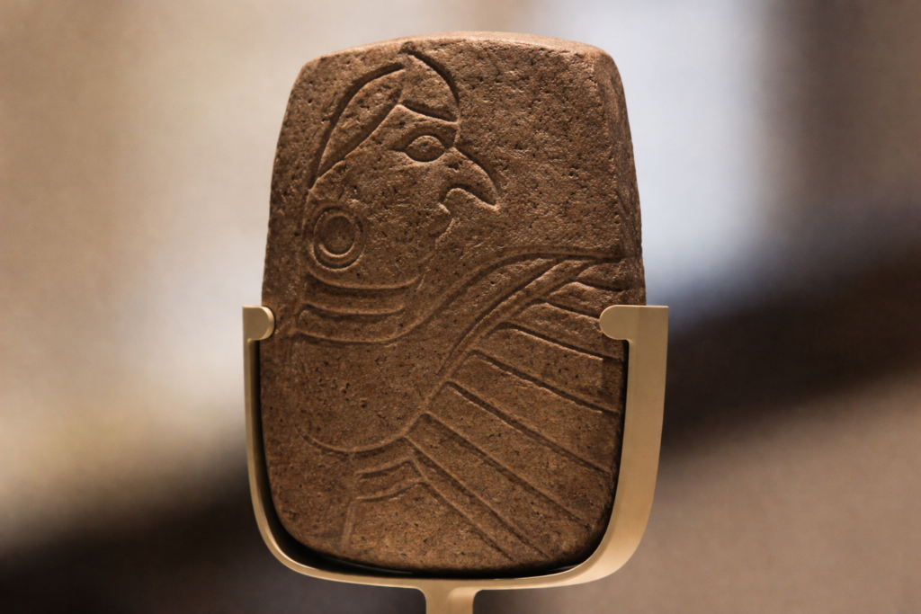
Iconography on shell and stone depicts fertility, warriors, and cosmology. Shared symbols crossed neighborhoods, signaling belonging beyond kin. Ceremonies in plazas synchronized belief, reinforcing moral order and obligations that stabilized a crowded, multilingual city during expansion, migration, and periodic social stress as populations surged quickly within limited urban space collectively.
Ritual also justified leadership decisions and labor demands. By embedding power in sacred narratives, elites gained compliance without coercion. This cohesion helped newcomers integrate rapidly, sustaining growth without constant conflict or fragmentation even as inequality widened and resources fluctuated across districts, seasons, and generations within a planned urban core environment.
8. Defensive choices favored openness over fortress building.
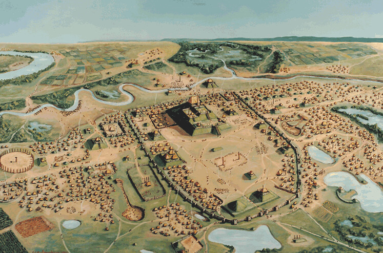
Cahokia lacked stone walls or moats, relying on social integration and distance. Peripheral palisades appeared late and selectively. Security likely came from alliances, ritual deterrence, and controlling access through causeways rather than constant militarization within a landscape offering natural buffers such as wetlands, rivers, and open fields around the core.
This choice reduced labor costs and kept trade flowing. Openness also projected confidence, deterring rivals through scale and coordination. When conflict arose, response relied on rapid mobilization rather than permanent fortifications enabled by roads, plazas, and shared obligations that bound communities during emergencies across the metropolitan region over time periods.
9. Population decline followed environmental and political strain.
After 1200 CE, construction slowed and neighborhoods thinned. Flood variability increased, soils tired, and trade networks shifted. Internal tensions likely grew as leadership struggled to balance obligations amid changing conditions documented through stratigraphy, pollen records, and settlement patterns visible across the American Bottom region during successive generations of inhabitants there.
Outmigration appears gradual, not catastrophic. Communities reorganized into smaller centers, carrying traditions elsewhere. Cahokia’s legacy persisted culturally even as the city faded, reminding archaeologists that decline can be adaptive rather than failure under changing environmental pressures affecting river societies across North America at similar historical moments during late prehistory periods.
10. Modern science keeps rewriting Cahokia’s true scale.
Lidar mapping strips vegetation to reveal roads, borrow pits, and neighborhoods beyond mounds. Dates tighten with improved radiocarbon models. The city’s footprint expands outward, challenging older maps drawn from limited excavation and reframing assumptions about population density through comprehensive regional survey coverage conducted over recent decades by interdisciplinary teams globally.
Each method layers evidence rather than overturning it, producing a clearer picture. Cahokia emerges as dynamic, planned, and influential. Its story reminds us complex cities thrived here long before colonial records began shaping histories that remain underappreciated today within the Mississippi Valley narrative recognized through ongoing research and public scholarship.