
More weekend storms reveal a longer flood trajectory.
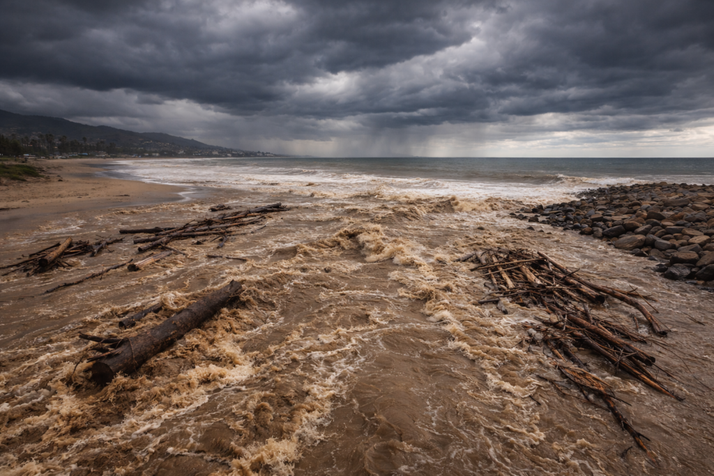
Heavy rain from Friday night through Sunday pushed large parts of California past a breaking point already weakened by weeks of storms. Rivers rose rapidly across multiple regions, streets flooded in urban corridors including Los Angeles County, and saturated hillsides in coastal and foothill communities began to slide as successive bands of rain moved inland from the Pacific.
The damage reflects this weekend’s rainfall, but the context is larger. Emergency officials and climate scientists warn these storms are no longer isolated events. They are stacking across regions, straining infrastructure from the Central Valley to Southern California, and signaling a prolonged flood era that may shape winters statewide.
1. Rainfall totals are overwhelming rivers beyond design limits.
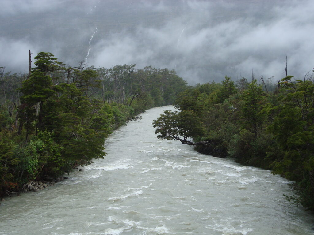
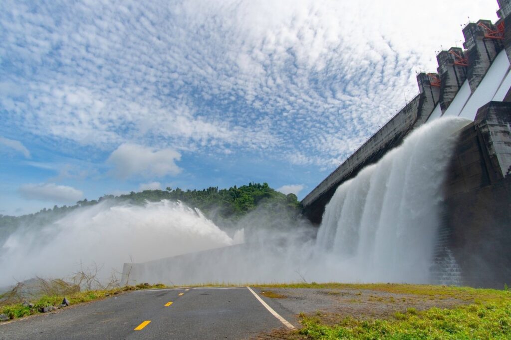
Repeated atmospheric rivers have pushed major waterways toward levels normally seen once in decades. Levees along the Sacramento and San Joaquin systems face constant pressure as soils remain saturated, leaving little margin for error. Flood managers now operate dams in a defensive posture, releasing water earlier than planned to avoid sudden failures, according to the National Weather Service.
That strategy protects downstream communities in the short term, but it also keeps rivers high longer. When another storm arrives before levels drop, flooding spreads quickly into towns and farmland. The result feels like disasters and more a cycle reshaping winter patterns.
2. Urban drainage systems were never built for this.
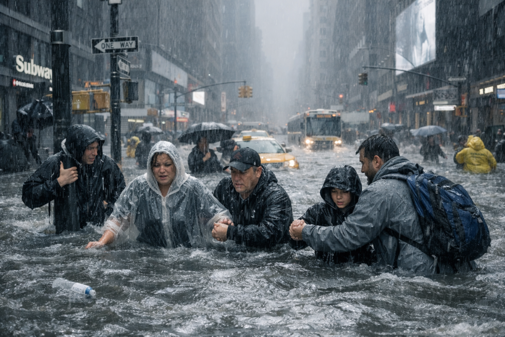
Cities rely on storm drains sized for brief heavy rain, not weeks of runoff. In Los Angeles County, concrete channels fill rapidly, forcing water onto streets and into neighborhoods built decades ago. As reported by the Los Angeles Times, aging infrastructure now collides with rainfall patterns that exceed original engineering assumptions.
Once water escapes those systems, recovery slows. Pumps, basements, and roads suffer repeated exposure, compounding damage each week. Insurance claims stack up, and renters face temporary displacement across many city blocks.
3. Saturated hillsides raise landslide risk across regions.
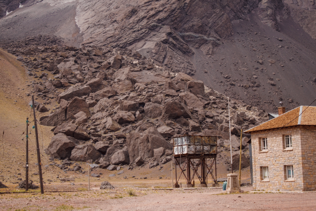
Soils already soaked lose their grip on slopes, especially near burn scars and road cuts. Northern California highways and coastal bluffs show early movement as rain continues to fall. Landslide hazard maps grow outdated quickly during seasons like this, as stated by the United States Geological Survey.
For residents, that instability adds a quieter danger alongside flooding. Mud and rock slides can close roads, isolate communities, and threaten homes without dramatic warning. Some zones remain unsafe for days afterward after rainfall.
4. Reservoir operations are shifting from storage to defense.
California reservoirs traditionally balance water supply against flood control, but relentless storms force constant adjustments. Operators release water earlier to preserve structural safety, even when snowpack and rain promise abundant supply. That tradeoff reduces flexibility later in the season, especially if storms persist into spring.
For downstream communities, steady releases mean rivers rarely rest. Fields stay wet, levees stay stressed, and emergency planning becomes continuous rather than episodic. Maintenance budgets strain as crews remain deployed for months at once.
5. Agricultural valleys absorb water with limited escape.
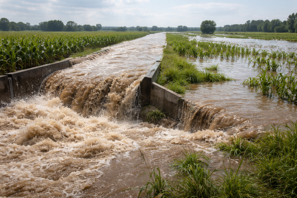
The Central Valley acts like a shallow basin, collecting runoff from surrounding mountains. When rivers overtop or seep through levees, water spreads across fields designed for irrigation, not inundation. Crops, roads, and farm housing face prolonged exposure that complicates recovery timelines.
Even after floodwaters retreat, saturated soils delay planting and invite pests. Economic losses ripple outward to food prices and rural employment. Some fields remain underwater for weeks, reshaping land use planning and testing financial resilience across multigenerational family farms throughout region.
6. Coastal areas face compound flooding from sea levels.
Along the coast, heavy rain meets high tides and rising seas. Storm drains struggle to empty when ocean levels push back, especially during king tide periods. Low lying neighborhoods experience water pooling that lingers longer with each passing year.
This interaction turns ordinary storms into coastal flood events. Saltwater intrusion damages infrastructure and soils, while insurance coverage grows harder to secure. Planning timelines stretch decades, but impacts arrive season after season, leaving residents anxious and adaptation efforts constantly behind pace locally.
7. Emergency response systems show strain under prolonged demand.
First responders manage floods while knowing another storm is queued. Equipment stays deployed, overtime rises, and personnel fatigue builds quietly. Small communities feel this pressure fastest, with volunteer departments stretched thin across weeks of incidents.
Coordination improves with experience, but constant activation erodes capacity. Recovery work overlaps with new emergencies, leaving little time to reset. Funding debates intensify as budgets built for short crises face long seasons, mutual aid agreements expand, yet resources remain finite statewide during repeated storm cycles that test endurance daily.
8. Groundwater recharge brings benefits mixed with new risks.
Floodwaters percolate into aquifers, helping refill basins depleted by drought. Some regions welcome this unintended recharge as a partial buffer against future dry years. Yet rapid infiltration can also mobilize contaminants stored in soils.
Managing that balance requires monitoring wells and adjusting land practices. Areas near industry or agriculture face higher stakes if polluted runoff seeps downward. Otherwise, communities inherit hidden problems beneath the surface for decades, cleanup costs rise and trust in water systems weakens slowly over repeated flood seasons that blur accountability lines regionwide.
9. Insurance markets adjust as flood risk recalculates.
Homeowners confront rising premiums or dropped coverage after repeated claims. Flood maps evolve, sometimes abruptly, changing which properties require protection. This financial pressure arrives alongside physical damage, shaping decisions about repair, relocation, or rebuilding.
Renters feel secondary effects as landlords pass costs along. Mortgage approvals tighten in high risk zones, cooling housing markets already under stress. Local governments weigh buyouts and zoning changes as exposure grows, equity concerns emerge when lower income residents lack options to move despite repeated losses during increasingly wet years across California.
10. Climate signals suggest wet extremes may persist.

Warmer oceans feed stronger storms, while shifting jet streams stall weather patterns. These ingredients combine to favor longer periods of heavy precipitation. The outcome challenges assumptions that wet years will quickly swing back to dry.
For California, adaptation becomes ongoing rather than episodic. Infrastructure, land use, and emergency planning must align with variability that leans wetter. Communities begin planning for water as both threat and resource, accepting uncertainty as a defining feature of future winters along the West Coast going forward.