
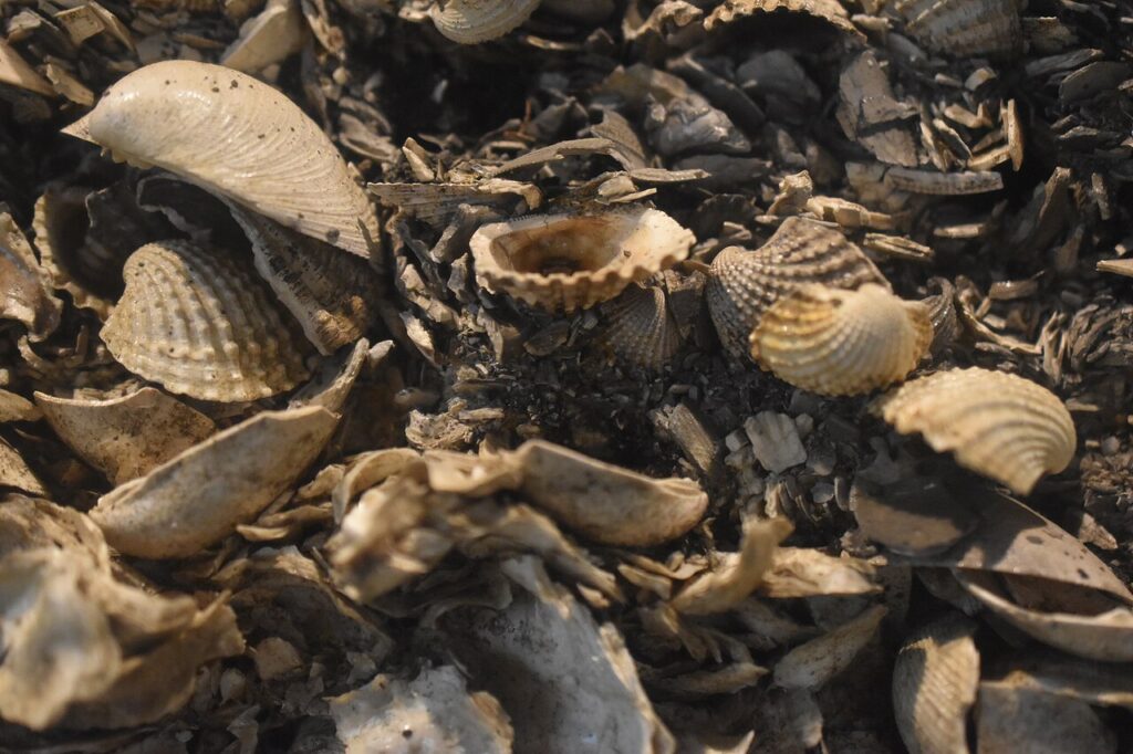
These heaps look boring until you read them.
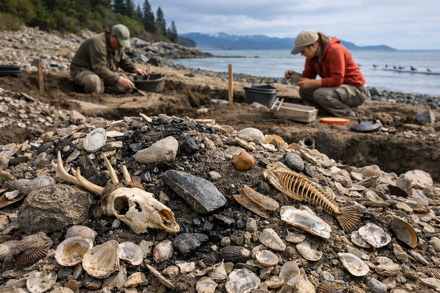
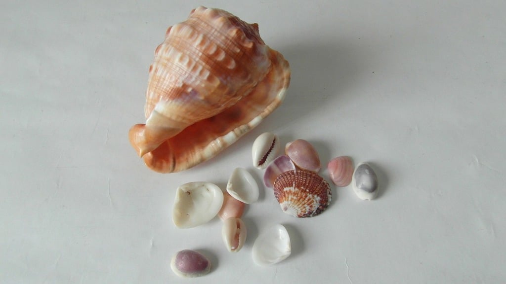
Along coastlines from the Pacific Northwest to Scandinavia and Japan, archaeologists keep finding the same strange landmark, huge piles of shells mixed with ash, bone, and broken tools. They are called shell middens, and they are basically ancient trash dumps that refuse to stay quiet. Because coastal food is seasonal and tides are predictable, these piles record habits with surprising precision. In many cases, they even preserve material that ordinary soils destroy, letting researchers reconstruct daily life in detail.
1. Shell layers can map seasonal harvest patterns.
A shell pile grows the way a calendar grows, one meal at a time. When archaeologists excavate a midden in thin layers, they can sometimes see repeating patterns that line up with the seasons. Certain shellfish are easiest to collect at specific times of year, and some species peak in size or abundance in predictable months. If one layer is heavy with mussels and another shifts to clams, it can hint at changing harvest spots or changing seasons of occupation.
The really useful clue is the shell itself. Growth rings and chemistry inside shells can reflect water temperature and salinity, which helps narrow down when the animal was collected. Middens can also include fish bones and plant remains that match seasonal runs or blooms. This is why a shell dump can read like a schedule, according to the National Park Service, which highlights how midden layers preserve repeated choices about when and where people gathered food.
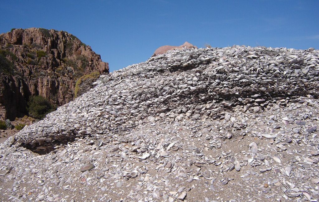
2. A midden’s height hints at long settlement.

Some shell piles are small, like a weekend of meals. Others rise into mounds that reshape the landscape. Size matters because shells are bulky, and people do not haul them around for fun. A tall midden usually means a site was used repeatedly, either by the same community across generations or by groups returning to the same reliable shoreline. That repeat use suggests stability, local knowledge, and a sense that the place mattered.
Depth can also reveal pauses. If archaeologists find a sterile layer of windblown sand between shell layers, it can indicate abandonment, flooding, or a shift in shoreline access. Some middens show rapid buildup that hints at large gatherings, while others grow slowly, suggesting regular small scale meals. Midden growth is not just about time, it is about intensity of use. The idea that shell mounds can reflect long term settlement history is discussed in Smithsonian Magazine, and it comes up often in coastal archaeology because the scale is hard to explain any other way.
3. Burn marks reveal cooking methods and fuel.
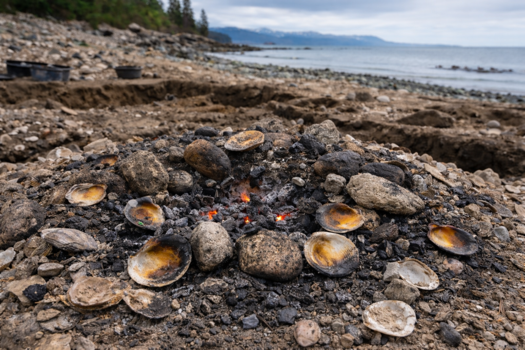
Shells do not just tell you what was eaten, they hint at how it was prepared. Burned shells, charcoal lenses, and ash layers can indicate repeated cooking events, sometimes in the same spot. A concentration of fire cracked rock may point to earth ovens or heated stone cooking. If shells are heavily scorched on one side, it can suggest roasting directly over heat rather than boiling.
Fuel choices leave their own trace. Coastal groups might burn driftwood, shrubs, or even seaweed in some regions, and those fuels produce distinctive charcoal fragments. The presence of hearth rake out, where ash and small bone are swept aside, can show how a living space was managed. Even the absence of burn marks matters, since raw or lightly cooked shellfish can be opened without fire. Archaeologists often connect these patterns to broader subsistence strategies, as reported by Encyclopaedia Britannica in its overview of shell middens and how they preserve traces of food preparation and domestic activity.
4. Tiny fish bones expose hidden food webs.
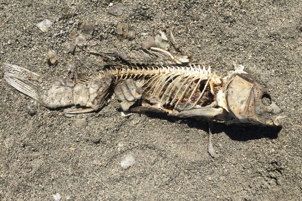
Shell piles are rarely only shells. The best ones are packed with tiny fish vertebrae, crab parts, sea urchin spines, and even bird bones. That mix matters because it reveals a broader food web, not just one lucky shellfish bed. A midden with lots of small schooling fish remains can point to netting or trapping, while larger fish bones may suggest hook and line fishing, spears, or tidal weirs.
These details also help reconstruct local ecology. If you find fish species that prefer kelp forests, it suggests nearby kelp habitat was healthy at the time. If the remains lean toward estuary species, it implies marshes and river mouths were productive. Some middens show heavy reliance on one resource, while others look like a balanced menu, which can reflect risk management. Coastal life can be generous, but storms and bad seasons happen, so variety in a midden often reads like a survival strategy, not just preference.
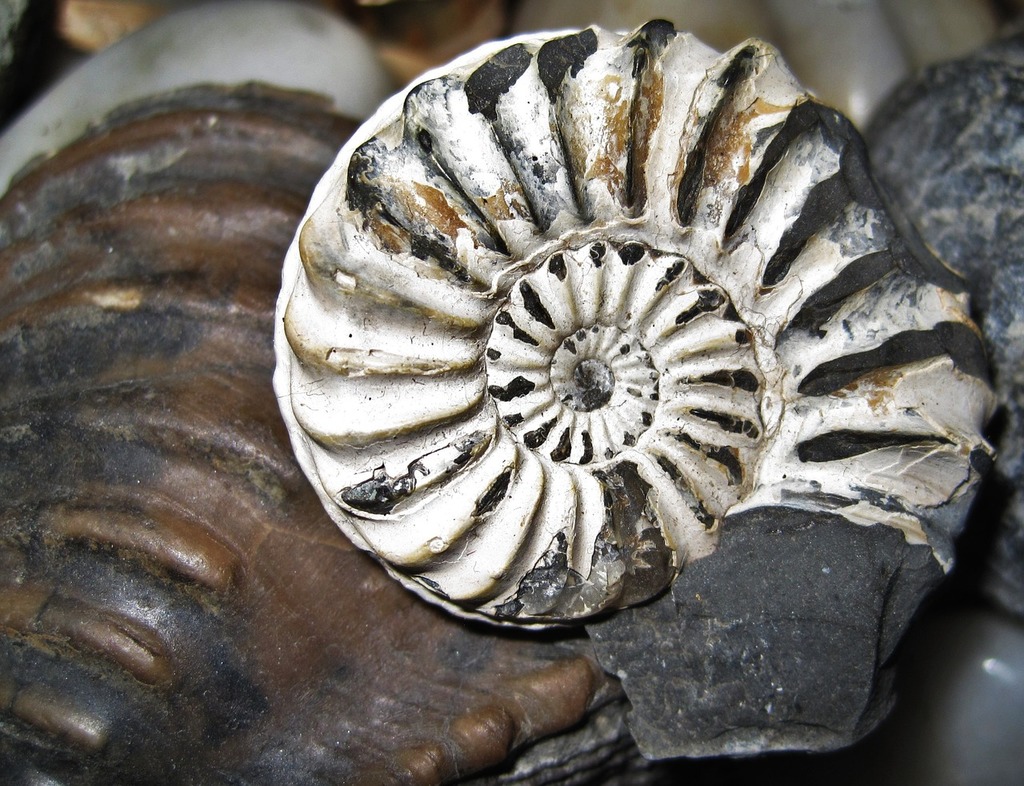
5. Unusual shells point to trade and travel.
Most people eat what is nearby, so a midden dominated by local species is expected. The odd moments are when shells appear that do not belong to that shoreline. A warm water species in a cooler region can suggest travel, exchange, or shifting currents over time. Sometimes the shell is not food at all. It may be a decorative species used for beads, pendants, or inlaid tools, which implies social value beyond calories.
Trade does not need long distance caravans to leave a trace. Even short hops between neighboring groups can move distinctive shells into new areas. When archaeologists match shell species to known habitats, they can estimate where people traveled or who they interacted with. If exotic shells cluster in specific layers, it may indicate a period of increased contact or alliance. In this way, a midden can record social geography, showing that coastal groups were connected networks, not isolated camps.
6. Discard piles sometimes mark boundaries and claims.
A midden is not always accidental. In some places, shell mounds are built up in visible locations, near shorelines, trails, or village edges. Over time, that mound becomes a landmark. Landmarks matter because they can signal territory, identity, and belonging. If a community repeatedly returns to the same place and leaves a growing pile, it can function as a durable sign that the spot is used and known.
This does not mean every shell pile is a boundary marker, but some patterns are hard to ignore. Middens placed at strategic points can indicate a shared understanding of space. In regions where multiple groups relied on the same coast, such markers could reduce conflict by making claims obvious. Even when not intentional, the effect is similar. A large mound changes movement through the landscape, shaping where people walk and where they gather, which feeds back into the social map of a coastline.
7. Tool scraps show how coast tech evolved.
Middens often contain broken tools and manufacturing debris, especially fragments of stone, bone, and shell implements. That material can reveal what coastal technology looked like at a given time. Bone points may suggest fishing methods. Ground stone can hint at plant processing. Shell can be shaped into scrapers, hooks, or cutting edges, and those tools may be favored when good stone is scarce.
The debris is useful because it captures the process, not just the finished object. Flake patterns can show how stone was worked, and wear marks can hint at what the tool did. If the tools change across layers, it can suggest innovation, shifting resources, or new cultural influences arriving through contact. In some regions, shell middens preserve organic tools that would normally rot away, which gives coastal archaeology a rare advantage. Instead of guessing how people solved daily problems, researchers can see the broken evidence of what worked and what failed.
8. Burials inside shells suggest ritual and status.
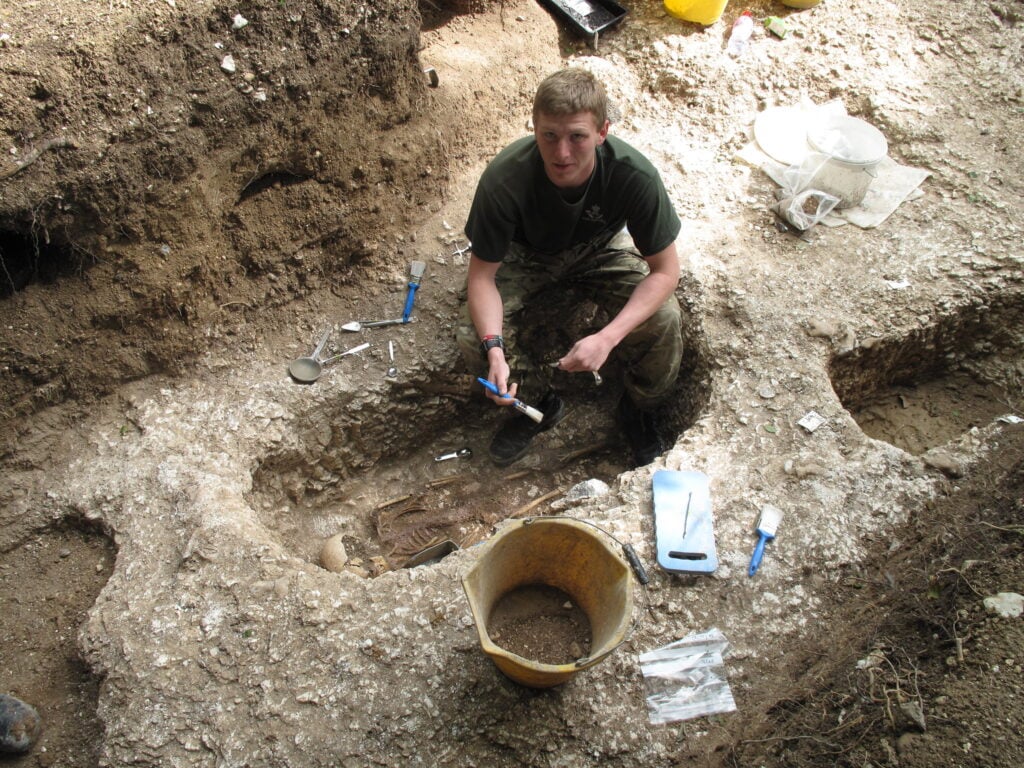
Some of the most striking midden finds are human burials placed within or beside shell deposits. That placement is rarely random. It can imply a connection between food gathering, ancestry, and place. In certain cultures, shell mounds became sacred ground over time, and burial there could signal belonging to a community that controlled that shoreline.
Burials also carry clues about status and care. Grave goods, body position, and the presence of shell ornaments can indicate social roles. Sometimes infants or high status individuals appear in distinctive contexts, suggesting that midden space was used selectively. The chemistry of bones and teeth can even reflect marine heavy diets, linking individuals directly to the coastal menu recorded around them. When a midden contains both daily refuse and formal burials, it becomes a record of life and death decisions, showing that subsistence sites could also be memory sites.
9. Shifting species signal climate swings and storms.

Coastal environments change fast, and middens can capture those shifts in a way that inland sites cannot. If layers show a sudden drop in one shellfish species and a rise in another, it may reflect changes in water temperature, salinity, or habitat. A storm can alter an estuary. A sea level shift can move a productive bed out of reach. Even a long drought can change river flow and coastal chemistry.
Because shells are sensitive to environmental conditions, they act like small climate recorders. Changes in size can hint at overharvesting or reduced productivity. Increased sand content can suggest storm surges or shoreline erosion. Sometimes a midden shows abrupt abandonment after a major environmental disruption. These patterns do not just tell a climate story, they reveal adaptation. When the menu shifts, it shows how coastal groups adjusted quickly, which resources they substituted, and how resilient their food systems were under stress.
10. Middens help reconstruct shoreline change over millennia.
Coastlines move. Sea level rises and falls. River mouths migrate. Dunes advance. Shell middens sit inside that motion like pins on a map. If a midden that was once coastal is now far inland, it signals shoreline retreat or land uplift. If it lies buried under later sediments, it can indicate flooding, delta growth, or changes in erosion patterns.
Archaeologists combine midden locations with radiocarbon dating, sediment studies, and local geomorphology to model how a coastline looked when people lived there. That matters because it prevents mistaken assumptions about where resources were. A site that seems oddly placed today may have been perfectly positioned beside a tidal flat thousands of years ago. Middens also preserve micro remains like tiny shells and plant bits that reflect former habitats. In that way, a pile of shells becomes a measuring stick for ancient landscapes, showing not only what people ate, but where the shore used to be.