
A forgotten stone has begun rewriting the map of Europe’s past.
For more than a century, it sat in near obscurity, heavy, carved, and misunderstood. No one suspected that its grooves might hold something far larger than decoration. Only recently did technology illuminate patterns that refuse to be dismissed as coincidence. Lines bend with purpose. Shapes repeat with intent. What first looked like abstract markings now suggest a mind trying to capture space itself. If that interpretation holds, then our assumptions about when Europeans first understood territory, borders, and landscape may have been misplaced for decades. The slab is no longer silent, and its implications stretch well beyond France.
1. The slab was first unearthed and then forgotten for decades.
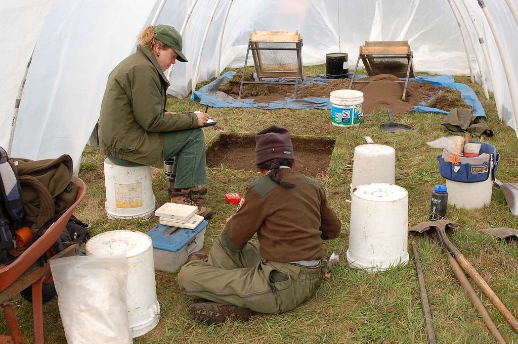
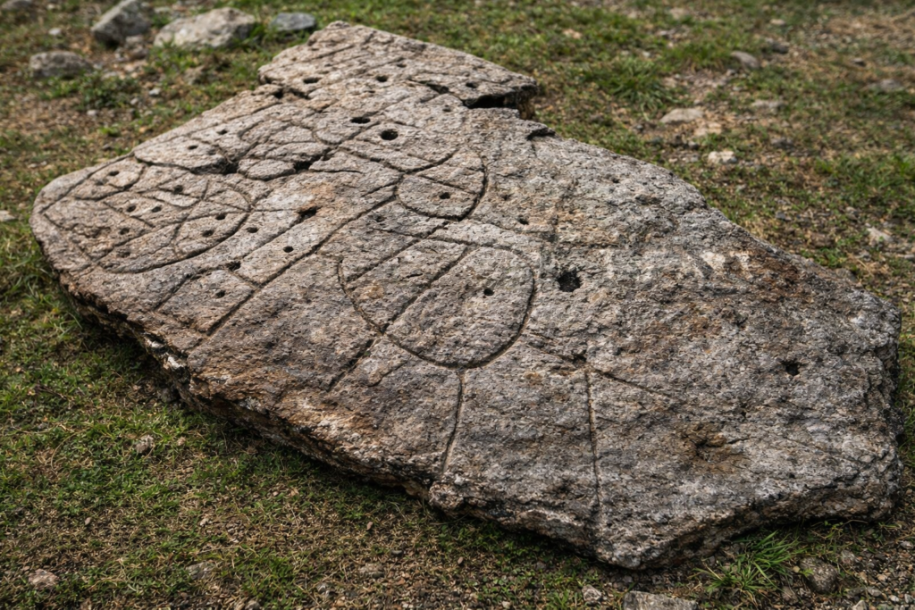
In 1900, French archaeologist Paul du Châtellier discovered a large engraved stone in a burial mound in Finistère, Brittany, but stored it in his estate cellar without realizing its significance. More than a century later, a team from France’s National Institute for Preventive Archaeological Research reexamined the piece and realized the carvings weren’t random decorations but a coherent map. According to their published findings in the Bulletin de la Société préhistorique française, the rediscovery revealed details that early 20th-century archaeology simply couldn’t detect. The stone’s long sleep preserved a snapshot of a vanished Bronze Age landscape.
2. Laser scans exposed symbols matching real river valleys and ridges.
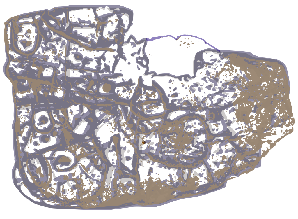
Using high-resolution photogrammetry and 3D laser mapping, scientists compared the slab’s etched patterns to the topography of the Odet River valley, where it originated. As discovered by researchers from CNRS and Bournemouth University, the engraved lines correspond to real river systems and ridges that matched the valley’s geography with remarkable precision. This analysis, published in Bulletin de la Société préhistorique française and later detailed by CNRS News, confirmed it wasn’t abstract art but deliberate landscape mapping, he first prehistoric artifact in Europe proven to depict a real region.
3. The carvings reveal an organized and hierarchical society.
As stated by France’s National Archaeological Research Institute, the mapped area may have covered a territory about 30 by 21 kilometers, possibly belonging to a local Bronze Age chiefdom. The slab’s markings, enclosures, boundaries, and repeated motifs, suggest structured land ownership or control. This interpretation implies social organization more complex than previously assumed for the period. The people who made it weren’t just farmers; they were surveyors of their own world, documenting terrain and influence long before written records appeared. The slab’s geometry carries the silent authority of early governance.
4. Its repurposing in a tomb hints at shifting power.
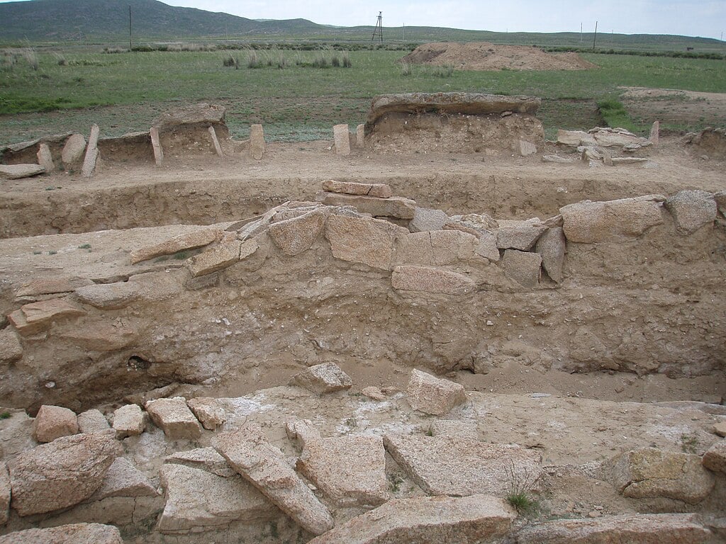
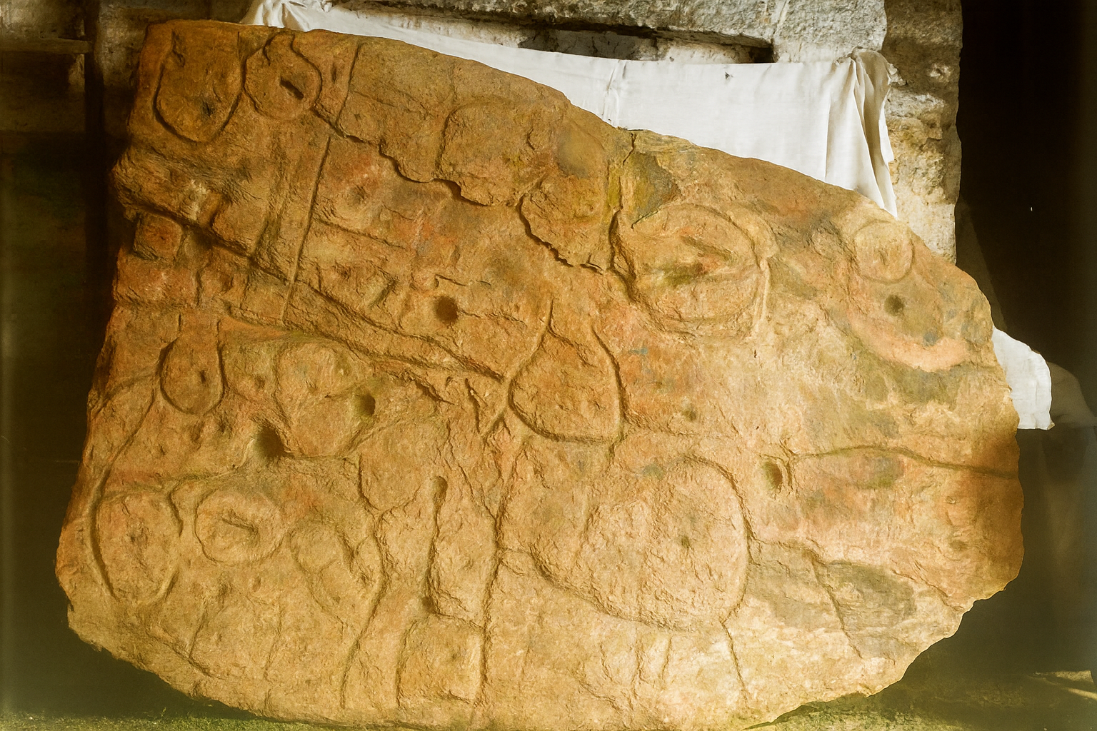
Centuries after it was carved, the same stone was broken and reused as part of a burial chamber. Archaeologists believe this act was symbolic, a deliberate fragmentation of an old political map after a regime or dynasty fell. Such reuse suggests a society that understood legacy and erasure, choosing to entomb both the ruler and the map that defined his reign. The act preserved the slab’s carvings under layers of soil, accidentally protecting them from erosion for millennia. Power literally went underground, only to resurface 4,000 years later.
5. The map’s accuracy rivals early historical cartography.
When researchers digitally reconstructed the slab’s layout, the contours and water systems aligned within 80 percent accuracy to the real terrain. That level of spatial awareness rivals medieval mapmaking, which appeared thousands of years later. The mapmakers likely used visual observation and collective memory rather than measurement tools. This sophistication suggests an emerging geographic consciousness, a sense that land could be recorded, divided, and remembered as a shared reference system, not just walked and inhabited. It’s the birth of mental mapping turned into stone.
6. Each mark carries both territorial and spiritual meaning.
In ancient societies, geography and belief were inseparable. Archaeologists propose that the Saint-Bélec map was as much about sacred stewardship as land control. Certain shapes might represent sanctuaries or ritual boundaries rather than property lines. The map could have been both a record of rule and a symbolic landscape connecting human and divine realms. What we see as geographic precision may have once been spiritual geometry, a Bronze Age attempt to reconcile land, ancestry, and power within one carved surface.
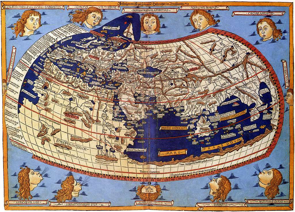
7. Its discovery challenges long-held assumptions about prehistoric Europe.
For decades, scholars believed map-making began with literate civilizations like the Babylonians or Greeks. The Saint-Bélec slab rewrites that timeline. It shows that prehistoric Europeans, far from being primitive, were capable of abstraction and spatial reasoning on a remarkable scale. It shifts the conversation from imitation to innovation: these people weren’t learning from others but independently inventing tools for representing space. This reframes Bronze Age Europe as a landscape of thinkers, not just farmers and warriors.
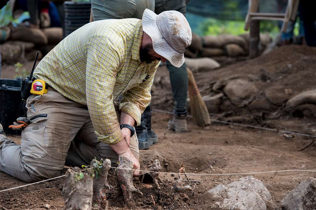
8. Technology revealed what the human eye once missed entirely.

Early archaeologists lacked the means to interpret the faint carvings. With today’s laser imaging, researchers can see depth variations of less than a millimeter. The resulting 3D scans illuminated subtle intersections and alignments invisible under normal light. Technology, in a sense, resurrected the mind of the ancient carver. It also showed how much of human prehistory remains hidden in plain sight, waiting for the right combination of patience and precision to bring it back into focus.
9. The slab’s future lies in both preservation and reinterpretation.
Now displayed at the Musée d’Archéologie nationale near Paris, the Saint-Bélec Slab continues to be studied with evolving imaging tools. Researchers are exploring whether pigments or markings once filled its grooves, potentially enhancing its readability in daylight. Every new scan deepens the conversation about early cognition and cartography. What began as a buried curiosity now serves as a tangible link between prehistoric intelligence and modern science, a dialogue across millennia etched into the same enduring piece of stone.