
A continent slowly tears itself apart beneath us.
Across the East African landscape, something ancient and unstoppable is unfolding. A massive crack, stretching for miles through Ethiopia, Kenya and beyond, is widening inch by inch as the continent splits along deep tectonic seams. The rupture first stunned geologists when it tore open suddenly in 2005, and new mapping shows the process accelerating. No human will witness the final outcome, but the signs already point toward an astonishing future. Africa is rearranging itself, and a new ocean is slowly taking shape.
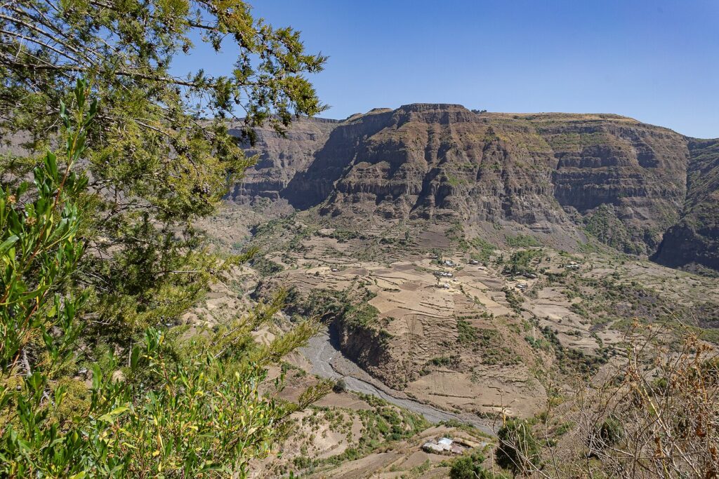
1. The crack follows the path of the East African Rift.
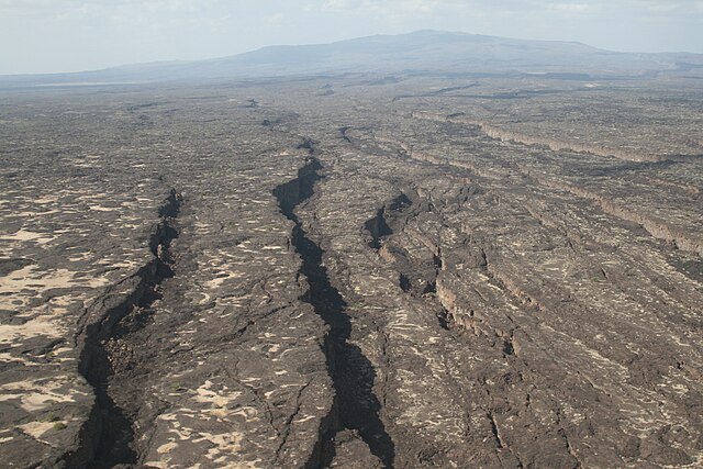
Geologists now know the widening tear in East Africa sits on a fault line powerful enough to reshape the continent. The slow drift of the Nubian and Somali plates has already erupted into violent motion, most famously in 2005 when the Dabbahu event ripped a 37-mile gash into the earth in barely ten days. The speed of the rupture stunned scientists who had never witnessed continental breakup happen so abruptly.
Now magma is rising again, weakening the crust and priming it for more fractures. The crack people see today is only the faintest outline of a massive rift carving its way downward, the opening act of a continent preparing to split in two.
2. Satellite radar shows the land pulling apart steadily.
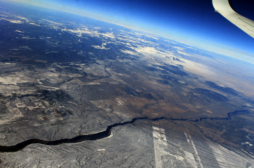
Using satellite based radar and ground sensors, scientists track the speed at which the rift expands. Recent observations show measurable widening every year, as stated by the United States Geological Survey. This movement is slow enough to escape daily notice but fast enough to reshape the landscape over human lifetimes. The pattern matches tectonic behavior seen in early ocean forming environments.
This steady shift causes roads, farms and villages to fracture or warp across Ethiopia and Kenya. Residents witness small changes long before they hear scientific explanations. The land itself becomes evidence of the continent’s future transformation.
3. The rift mirrors early stages of famous ocean basins.

Research teams comparing the East African Rift to the Red Sea and Atlantic Ocean found key similarities during early rifting stages, as reported by BBC News. The combination of volcanic activity, thinning crust and subsiding valleys mirrors what occurred before the Atlantic opened. This strengthens the theory that the region is evolving toward a full ocean basin.
Volcanoes, geysers and lava filled fissures reflect the strain building beneath the surface. Over immense timescales, these features signal a process that ends with seawater rushing inland to occupy a widening gap. Africa prepares for a distant yet inevitable transformation.
4. Volcanic systems in the region are becoming more active.

Rifting increases volcanic activity as magma rises to fill the growing void between tectonic plates. In Ethiopia’s Afar region, eruptions have increased in frequency, and lava lakes continue to fluctuate dramatically. These changes follow patterns seen where new crust forms along mid ocean ridges. Geologists use volcanic signals to predict how the rift evolves.
Communities living near these volcanoes report subtle land changes long before major events. Cracks form in fields, hot springs shift temperature and the ground sometimes trembles without warning. These signs reflect the active forces reshaping the region.
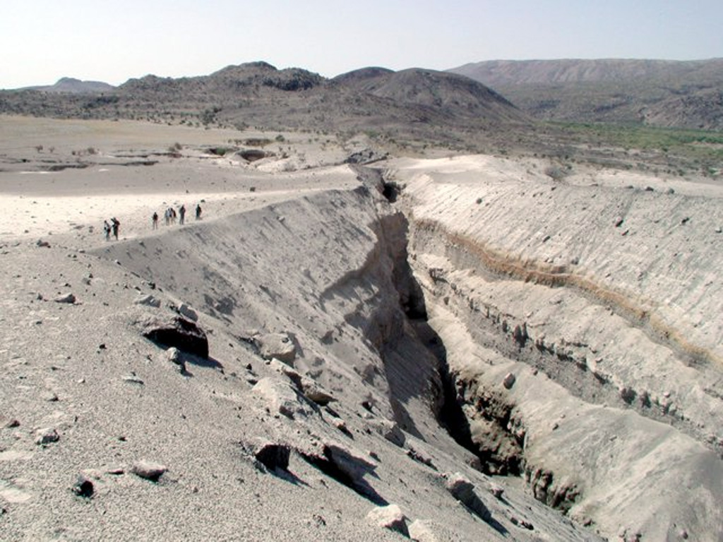
5. Earthquakes accompany the continent’s gradual split.
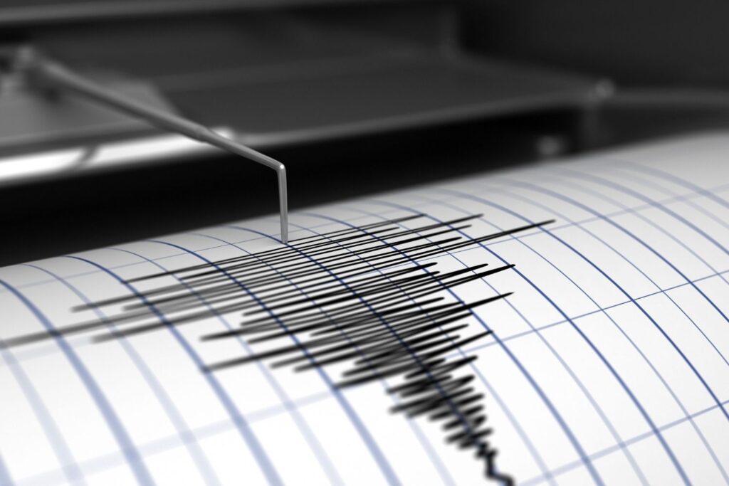
As plates stretch and fracture, pressure shifts trigger frequent earthquakes, many too small to feel. Larger quakes occasionally strike, revealing where stress has accumulated. These quakes carve new weaknesses that eventually widen into faults. The seismic pattern outlines the path along which Africa will divide.
People living along the rift often describe sudden jolts that interrupt daily life without causing major damage. Yet every quake marks another incremental step in the continent’s evolution. The tremors form a constant reminder of forces operating beneath the surface.
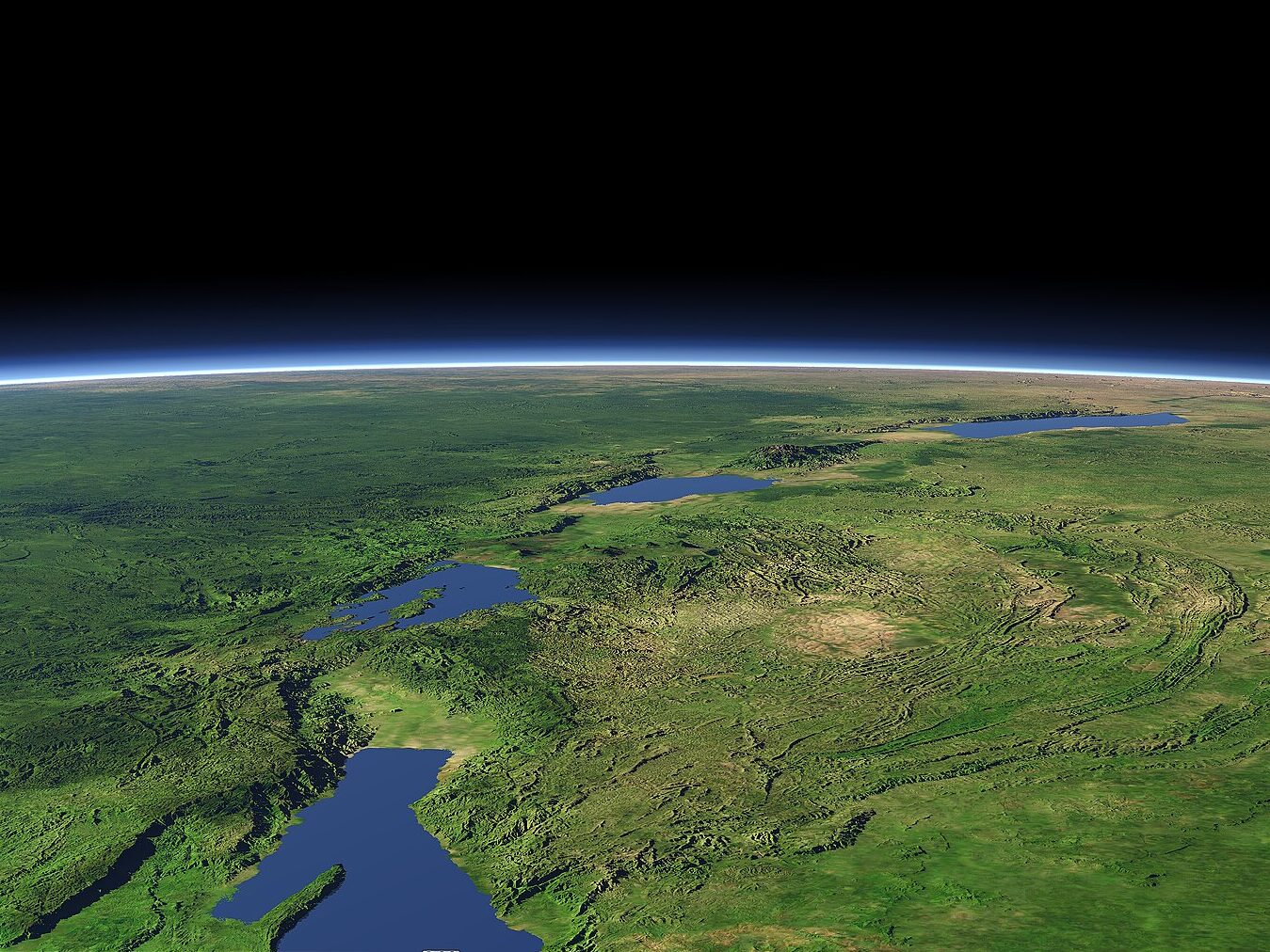
6. A depression is forming that will someday fill with seawater.
The rift valley sinks slowly as the crust thins, creating a massive bowl shaped depression stretching through several countries. When the land drops low enough and the connection to the sea opens, ocean water will rush in and form a new basin. Scientists estimate this may take millions of years, but the trend is unmistakable.
Some areas already lie below sea level, hinting at the shape of the future ocean. The geography shows clear signs of subsidence and expansion as the land adjusts to tectonic changes.
7. The Red Sea could spill inward during future stages.
If the rift continues to widen and volcanic barriers eventually break, seawater from the Red Sea may flood into the deepening valley. Models predict that once an open connection forms, the inflow will be rapid and irreversible. The resulting ocean would separate the Horn of Africa from the rest of the continent.
This scenario resembles how the Red Sea itself formed. What begins as a narrow gulf eventually becomes a wide ocean basin. The early signs visible in East Africa match this ancient pattern closely.
8. New coastlines would eventually reshape human settlement.
Over geologic time, the countries along the rift could develop entirely new shorelines. Cities now far inland may find themselves near oceanfront landscapes. Trade routes, ecosystems and weather patterns would shift dramatically as water reshapes the region.
The transformation would unfold so slowly that countless generations would adapt without witnessing its completion. Still, the earliest indicators are already visible, and communities living along the rift experience gradual changes each decade.
9. Wildlife migrations are already shifting with the land.

As valleys deepen and volcanic activity reshapes terrain, animal populations adjust their routes. Some species move toward safer ground or seek new water access as lakes form or drain within the rift valley. These changes reveal how sensitive ecosystems are to subtle geological processes.
Wildlife researchers track these migration shifts as clues to the land’s evolution. When herds alter long established routes, it often signals deeper forces changing the environment beneath them.
10. Scientists consider the rift one of Earth’s rarest events.
Continental breakup is one of the slowest and most dramatic transformations on the planet. Earth hosts only a few active rifts with the potential to form new oceans, and East Africa is the most accessible for study. Its scale and activity offer scientists a chance to witness the earliest stages of a process that shaped every ocean on Earth.
For researchers, the region is a natural laboratory. For residents, it is a landscape in constant motion. The crack visible today may be ancient history tomorrow.