
Climate extremes are reshaping American geography today.
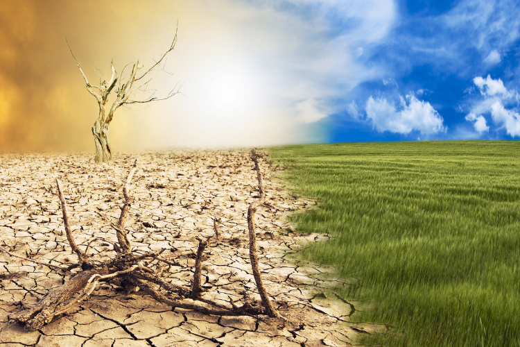
Hurricanes are intensifying, ice storms are crippling infrastructure, flooding is devastating communities, and heat waves are breaking records across the country. Americans are beginning to ask uncomfortable questions about where they and their children will actually be able to live safely. Recent disasters from Hurricane Helene’s catastrophic flooding to California’s devastating wildfires have shattered long-held assumptions about climate safety.
Scientists are analyzing everything from flood patterns to infrastructure durability, identifying which parts of the country can handle multiple climate threats simultaneously. These ten regions keep appearing in resilience research across different studies, representing diverse geographic areas from every corner of the nation because they possess specific advantages that matter when facing unpredictable extremes.
1. The Great Lakes basin provides freshwater security.
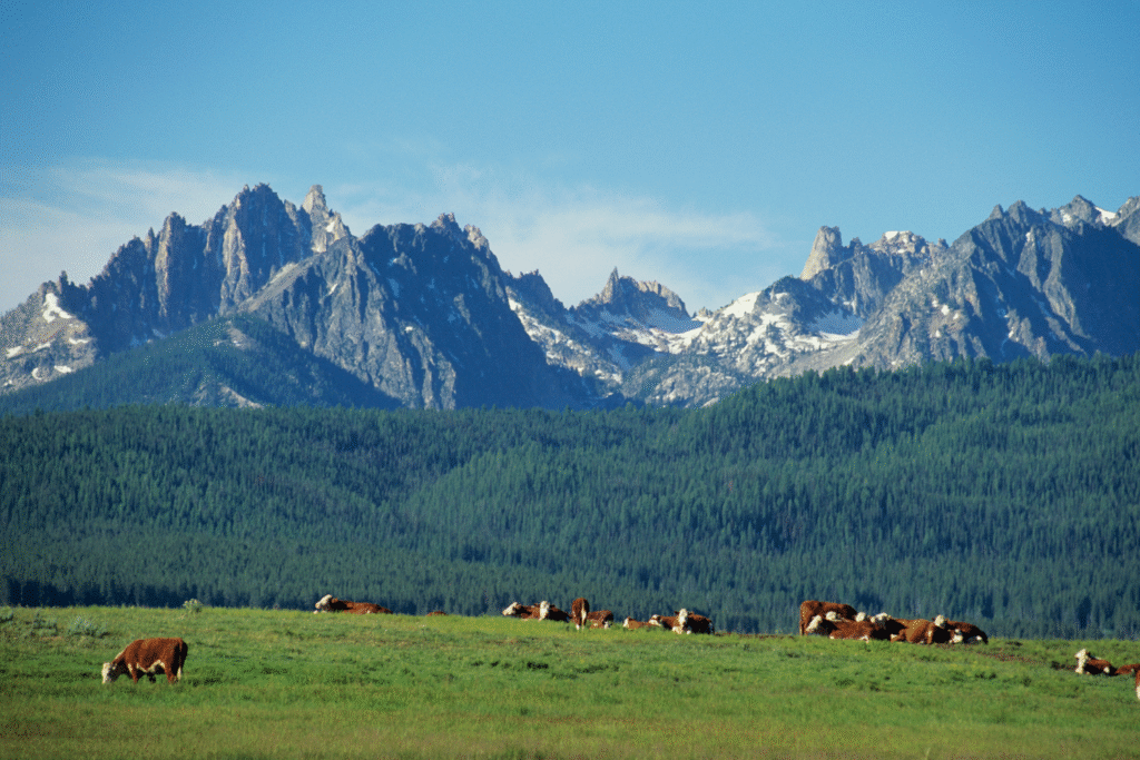
The Great Lakes region, spanning Michigan, Wisconsin, Minnesota, Illinois, Indiana, Ohio, Pennsylvania, and New York, takes top rankings in climate resilience analyses thanks to fairly low susceptibility to most major climate threats. The region holds roughly 20 percent of the planet’s surface freshwater supply, providing both drinking water and temperature moderation that becomes critical during extreme weather events.
The massive lakes create moderating effects on temperatures, keeping summers cooler and winters less brutal than surrounding areas would otherwise experience. Infrastructure built to handle genuine winter weather means ice storms do not paralyze these communities like they would unprepared regions. Cities throughout the region already manage snow and ice effectively, meaning sudden freezing events would not catch them off guard the way southern cities were devastated.
2. The Front Range offers elevation advantages.
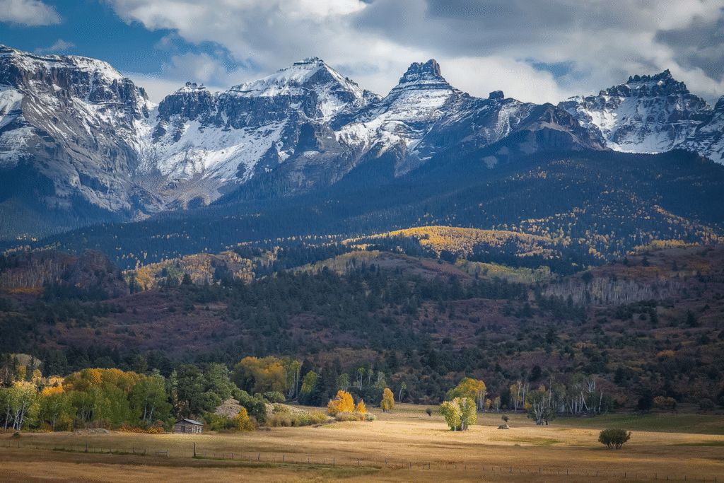
The Front Range urban corridor stretching from Colorado Springs through Denver to Fort Collins benefits from high elevation that provides natural protection from coastal flooding while maintaining access to mountain water resources. Denver sits at 5,280 feet, with the broader region ranging from 5,000 to 6,000 feet in elevation.
The region has experienced limited catastrophic weather destruction aside from occasional drought conditions and tornadoes. Cities along the Front Range have invested heavily in clean energy infrastructure, green spaces, and renewable energy. The combination of elevation, relatively mild weather patterns, and strong community focus on sustainable practices positions this region to handle climate variability better than low-lying areas.
3. The Upper Midwest balances continental stability.

The Upper Midwest, encompassing Minnesota, Wisconsin, North Dakota, South Dakota, and parts of Iowa, benefits from inland location that avoids coastal flooding while maintaining access to abundant freshwater from rivers, lakes, and aquifers. Only around 3 percent of Minnesota’s population lives in major floodplains, with projections showing minimal increases in flood risk.
Cold winters are moderating but not disappearing, maintaining conditions that deter some pests and diseases spreading northward with warming temperatures. Agricultural land throughout the region will see extended growing seasons, potentially becoming more productive rather than less, unlike regions facing water scarcity or extreme heat. States in this region have invested in renewable energy infrastructure and climate planning more aggressively than many others.
4. Northern New England maintains traditional resilience.
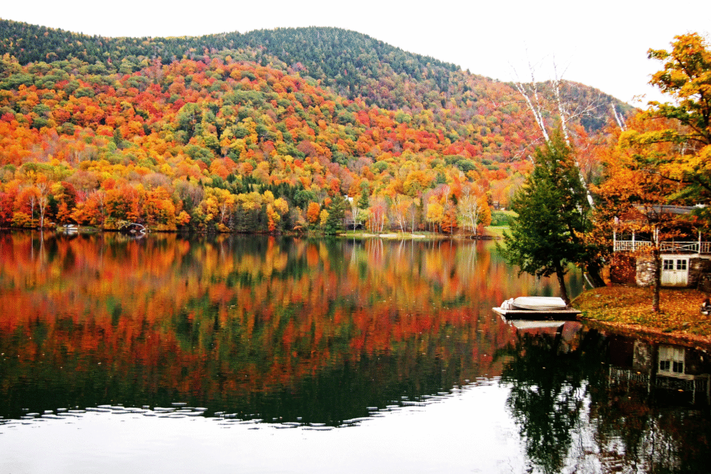
Vermont, New Hampshire, and Maine represent a region that has experienced only 45 federally declared natural disasters since 1953 in Vermont’s case, rating among the least vulnerable areas for overall climate risk. The region benefits from diverse ecosystems and four-season climates that are shifting but not collapsing entirely.
Higher elevations throughout the region translate to cooler temperatures even as the planet warms, giving mountain communities a buffer that low-lying areas cannot access. The Northeast benefits from reliable precipitation that continues to fall, avoiding the megadroughts plaguing western states while the risk of catastrophic wildfires remains substantially lower than in dried-out forests elsewhere.
5. The Piedmont plateau navigates southeastern challenges.

The Piedmont region of North Carolina, from Raleigh through Greensboro to Charlotte, sits at moderate elevations between coastal plains and Appalachian Mountains. This positioning provides protection from coastal storm surge while avoiding the flash flooding risks of mountain valleys. The region sits far enough inland to reduce hurricane impacts while maintaining enough elevation to manage heavy rainfall.
Raleigh was ranked as the second most climate-resilient city by Architectural Digest in 2023, demonstrating the region’s advantages. The Piedmont has developed advanced flood warning systems and invested heavily in climate education programs and community resilience planning. The region’s proactive adaptation strategies separate prepared communities from vulnerable ones throughout the Southeast.
6. The Interior Northwest avoids coastal extremes.
Eastern Washington, northern Idaho, and parts of eastern Oregon comprise a region with a dry, temperate climate distinctly different from the wet Pacific coast. This area remains less susceptible to the intense rainfall and flooding events affecting Seattle and Portland while avoiding the worst wildfire zones threatening more densely forested coastal areas.
The region benefits from four real seasons and access to water resources from rivers fed by mountain snowpack without the vulnerability of low elevation coastal areas. Distance from the coast eliminates tsunami risks and reduces exposure to atmospheric rivers that dump extreme precipitation on the Pacific Northwest coast. The Interior Northwest maintains economic diversity and growing urban centers.
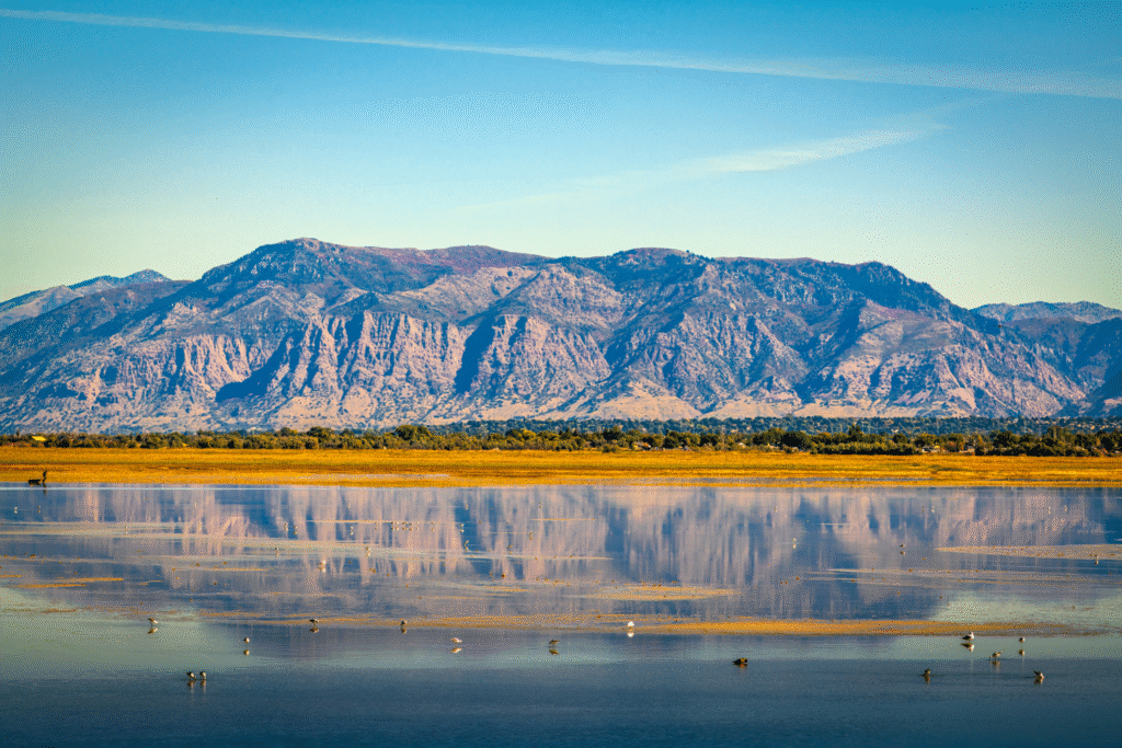
7. The Interior Southwest leverages high desert conditions.

The region around Salt Lake City, Boise, and parts of Nevada and Utah sits at elevations ranging from 4,000 to 6,000 feet in valleys surrounded by mountains. Salt Lake City sits at 4,226 feet, providing natural cooling and complete protection from sea level rise while offering access to mountain water resources.
The relatively low frequency of major natural disasters compared to coastal or tornado-prone regions provides time and resources to build resilience infrastructure. Cities in this region have committed to achieving 100 percent renewable energy and significant reductions in greenhouse gas emissions. The high desert climate avoids humidity-driven heat stress while elevation moderates temperature extremes.
8. The Northern Appalachian valleys balance access with protection.
The northern portions of the Appalachian region, spanning parts of Pennsylvania, New York, and West Virginia, benefit from mountainous terrain that provides varied elevation options and natural drainage systems. The region contains river valleys that provide water access and transportation corridors without the extreme vulnerability of coastal plains.
Pittsburgh and similar communities possess infrastructure originally built to support heavy industry, meaning robust construction and redundant systems that provide unexpected advantages in durability. Four distinct seasons persist, with infrastructure designed to handle both summer heat and winter ice storms. The transformation from industrial to technology-focused economies demonstrates adaptive capacity.
9. The Upper Great Plains adapt to continental conditions.
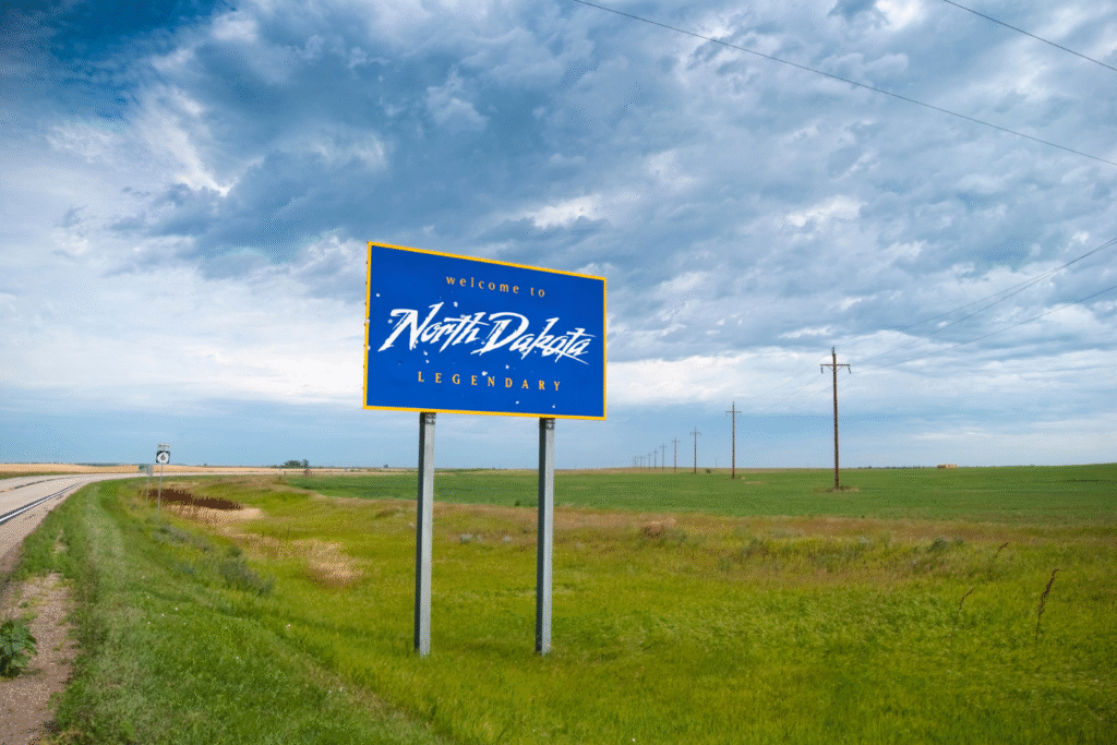
North Dakota, northern South Dakota, and eastern Montana comprise a region with low population density, abundant agricultural land, and distance from both coasts. The region experiences genuine temperature extremes, so infrastructure handles variability as normal operations rather than emergencies that paralyze unprepared areas.
The Upper Great Plains avoid the tornado intensity of regions farther south while maintaining enough precipitation to support agriculture without the water scarcity plaguing the Southwest. Energy development, both fossil fuels and renewables, provides economic diversity that helps communities weather disruptions. The region’s experience with harsh conditions builds resilience through preparation rather than hoping for mild weather.
10. The Driftless Area defies typical vulnerability patterns.
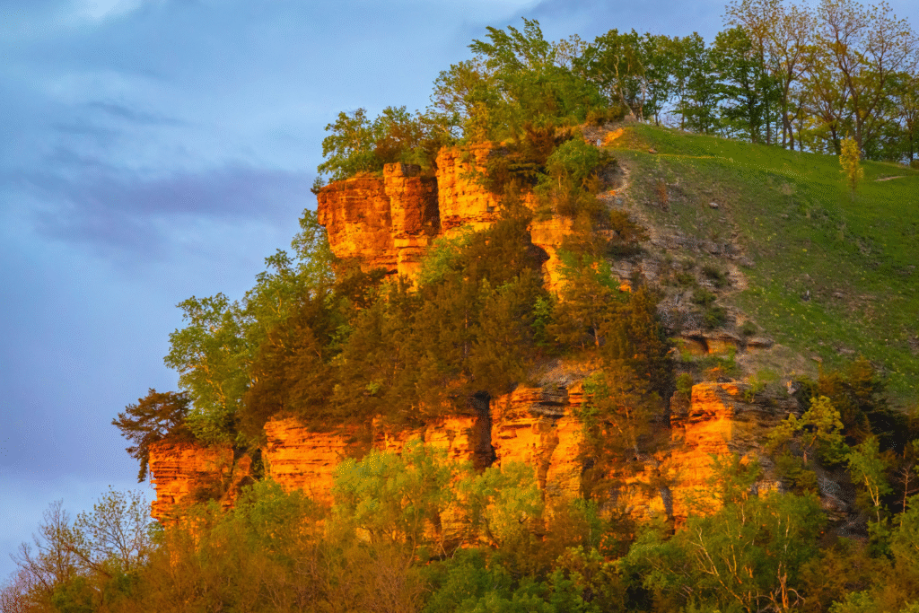
The Driftless Area, spanning southwestern Wisconsin, southeastern Minnesota, northeastern Iowa, and northwestern Illinois, was bypassed by glaciers during the last ice age, creating unique topography with natural drainage and varied elevation. The region manages both flooding and extreme weather effectively through geography that channels water safely.
Small communities throughout the Driftless Area maintain agricultural traditions while possessing tight social networks that mobilize during emergencies. The landscape functions brilliantly under stress, with hills that provide elevation options and valleys with natural drainage. This region will never make headlines, but its quiet competence at handling whatever nature delivers may prove more valuable than dramatic geography accompanied by dramatic vulnerabilities.