
Storms, heat, and floods are rewriting the forecast.
America has already weathered a turbulent 2025, and forecasters warn the year’s disruptions are far from finished. From unrelenting heat waves to back-to-back floods, the pattern is less about isolated disasters and more about a system that refuses to calm down.
Meteorologists now describe the atmosphere as unstable, with shifting jet streams and ocean temperatures conspiring to make extreme weather the new baseline. For families already rebuilding from spring storms, the forecast suggests a difficult reality: the calendar may keep flipping forward, but the chaos doesn’t plan on slowing.
1. Heat waves are lingering longer than expected.
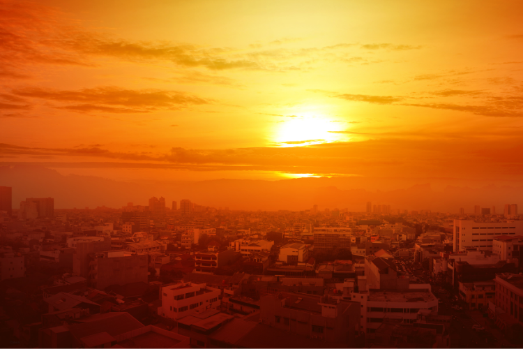
Cities from Phoenix to St. Louis have endured runs of triple-digit temperatures that simply don’t ease at night. According to NOAA’s Climate Prediction Center, heat waves in 2025 are lasting longer and arriving earlier, straining public health systems. Emergency rooms across the Midwest report spikes in heat-related illness, while grid operators scramble to balance demand. These waves are not flukes but part of a repeating rhythm. By summer’s midpoint, many meteorologists were already warning that prolonged heat would remain a recurring feature into fall.
Communities are scrambling to adapt. Cooling centers fill quickly, and neighborhoods without reliable air conditioning carry the heaviest burdens. The problem stretches beyond comfort; hotter nights prevent bodies from recovering, making each day more dangerous than the last. Residents know that what once felt like a seasonal annoyance has transformed into a public health crisis, one that seems destined to linger.
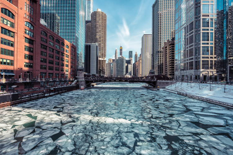
2. River flooding continues long after spring rains ended.
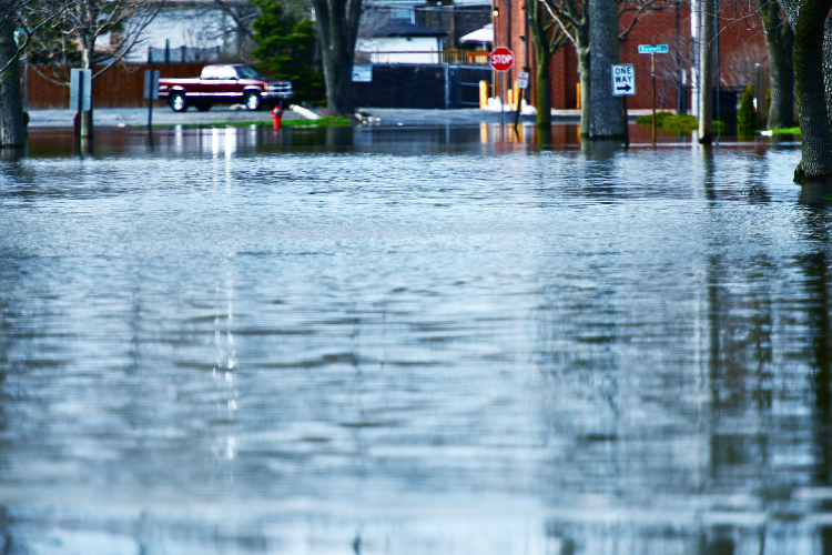
The Mississippi and Missouri river basins have seen repeated floods even as rainfall totals fell back toward normal. As stated by the U.S. Geological Survey, swollen tributaries fed by upstream storms and rapid snowmelt are keeping rivers above flood stage into late summer. The effect ripples through towns where levees and sandbags are still stacked high months after they were first placed.
For farmers, it means another season of uncertainty. Fields planted in May were drowned by June, leaving crop insurance as the only lifeline. Those living along riverbanks talk about exhaustion, the kind that comes from never being able to put shovels and pumps away.
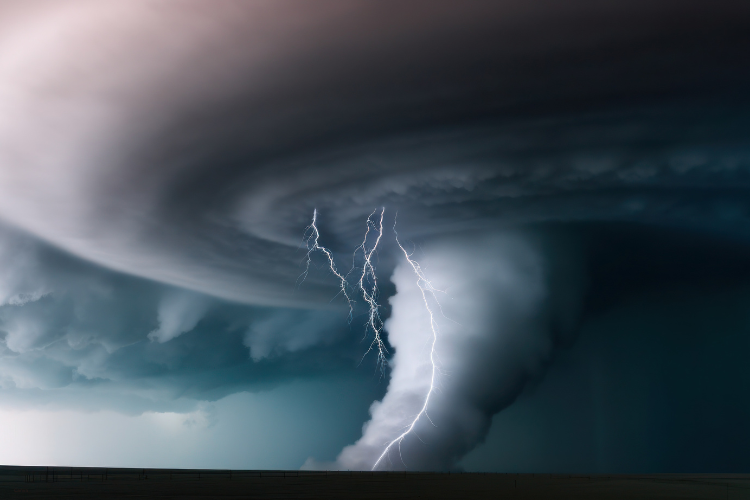
3. Tornado activity is stretching outside its traditional season.
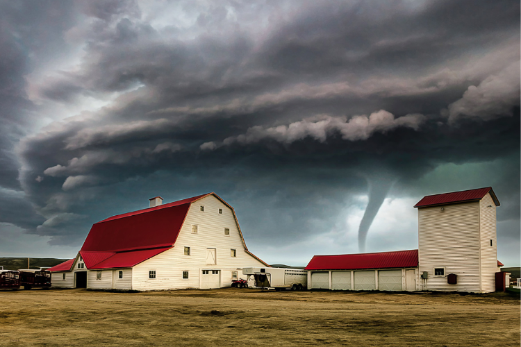
Normally, tornado counts peak in spring, but 2025 has seen outbreaks flare across the Plains well into July. As reported by the Storm Prediction Center, more than a dozen EF-2 or stronger tornadoes touched down after the Fourth of July holiday, cutting across Oklahoma, Kansas, and even parts of Illinois. Scientists point to warmer-than-average Gulf waters feeding moisture northward as one of the triggers.
Survivors describe the storms as relentless. Rebuilding after a spring strike only to be hit again in midsummer drains resources and patience. Towns that once braced for storms in April now carry that vigilance through summer cookouts, unsure when the skies will turn again.
4. Wildfire smoke keeps crossing state lines.

Western states burned heavily this summer, but the reach of smoke traveled far beyond the mountain ranges. Residents in Denver, Chicago, and even Boston reported hazy skies and poor air quality warnings. Fire seasons have lengthened as hotter, drier weather dries out forests earlier each year. The smoke does more than obscure sunsets—it complicates breathing for millions and pushes schools to cancel outdoor sports.
People are learning that wildfire no longer feels like a regional problem. Even if flames never reach your town, the air carries their signature hundreds of miles. Meteorologists stress this transport will remain a recurring challenge as fire activity ramps up in the West.
5. Hurricanes are carrying their punch inland.

Coastal residents from Texas to North Carolina know the drill with hurricane prep, but this year has highlighted a growing issue inland. Storms that make landfall aren’t fizzling out quickly. Instead, heavy rain bands are carrying destruction deep into states like Kentucky and Tennessee. The reason lies partly in warmer ocean waters feeding storms to higher intensity before landfall, leaving them with more fuel to burn.
Those miles inland once felt like safe ground. Now residents far from the shoreline are filing FEMA claims, discovering that hurricane recovery isn’t just for those living near the sea. The definition of vulnerable geography is stretching with every storm season.
6. Drought is creeping into places it rarely touched before.
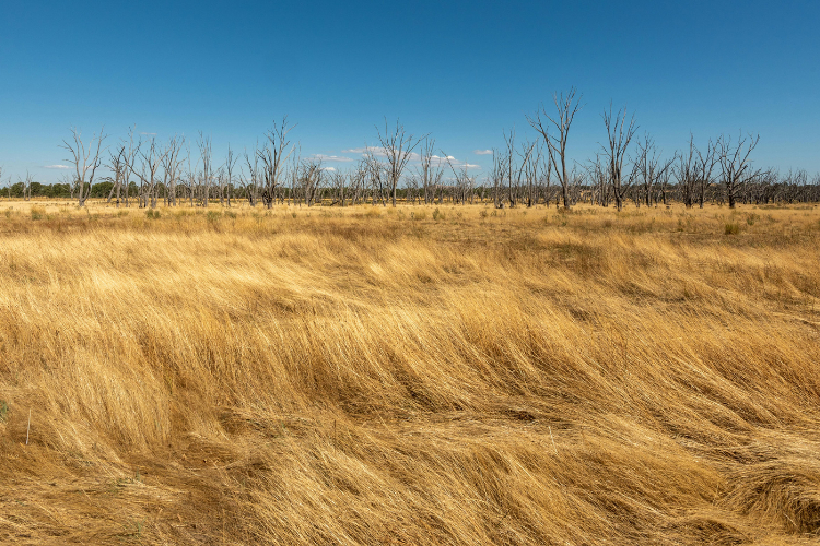
The Pacific Northwest has watched reservoirs shrink and crops wither, regions once considered safe from chronic drought. This year, Spokane and Portland both reported water restrictions, a development more common to Southern California than Oregon or Washington. Climatologists note that rising global temperatures are shifting rainfall patterns, turning once-reliable wet seasons into question marks.
For families relying on groundwater, wells dip lower, requiring costly drilling to keep taps running. Rural communities say they never planned for this, and now find themselves rushing to conserve and adapt, with little financial cushion to fall back on.
7. Snowpack is no longer storing water reliably.
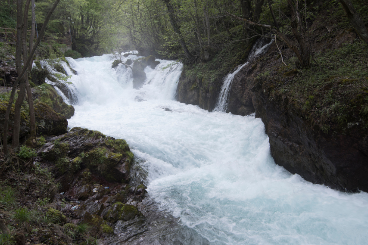
The Rockies usually hold snowpack that melts slowly through spring, feeding rivers downstream. This year, however, warmer March and April temperatures led to a rapid melt. That early runoff caused spring flooding, but by late summer, reservoirs were already straining. Hydrologists describe it as losing water storage twice—too much too soon, then not enough later.
Cities like Salt Lake and Albuquerque are already warning about tight restrictions heading into autumn. The problem illustrates how warming reshapes not just storms but the timing of water itself, leaving entire regions scrambling to rewrite their resource plans.
8. Insurance companies are retreating from risky zones.

Weather chaos isn’t only measured in degrees or inches—it shows up in rising premiums and disappearing coverage. Families in Florida, Louisiana, and California already know the sting of insurers leaving high-risk markets. Now, 2025 has seen carriers quietly pulling back in Midwest flood zones and even in wildfire-prone stretches of Texas Hill Country.
The change ripples through entire communities. Mortgage approvals stall, small businesses hesitate to expand, and homeowners wonder how long they can hold on. What was once a niche concern is now creeping into middle America’s balance sheets, reshaping financial security.
9. Jet streams are wandering off their usual paths.
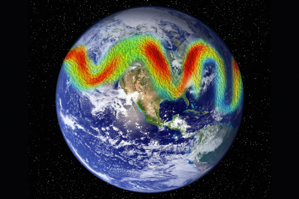
Meteorologists keep pointing to the jet stream as one of the most unpredictable characters this year. Normally stable flows of high-altitude wind have dipped south and lingered north in erratic ways. Those shifts set up blocking patterns, where storms stall and pour rain for days, or heat domes lock in over entire regions.
The effect feels less like traditional weather and more like a pattern gone adrift. Scientists warn this unpredictability could be the new normal, as Arctic warming destabilizes the atmospheric balance. For now, it means forecasts carry more uncertainty than families want to hear.
10. Urban centers are struggling to absorb the shocks.
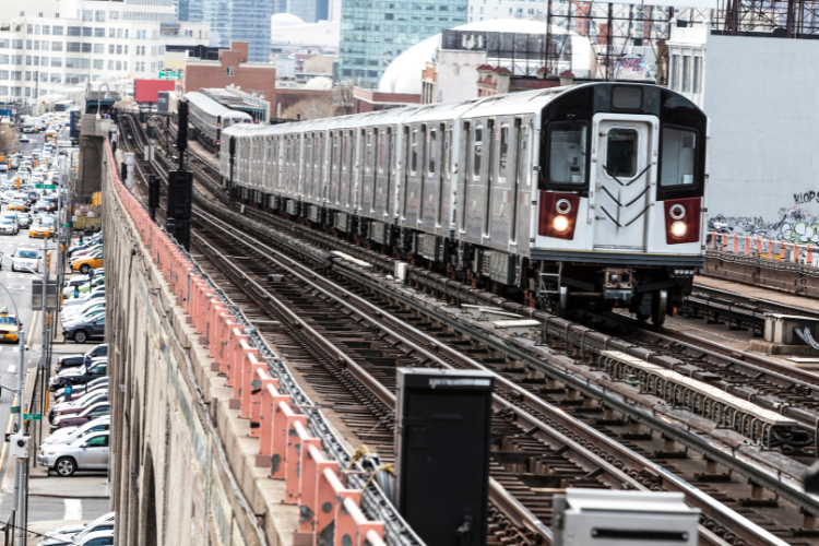
Cities aren’t built for these compounding stresses. Heat islands amplify temperature spikes, outdated drainage systems can’t handle stalled storms, and infrastructure cracks under repeated tests. Chicago, New York, and Houston all reported transit shutdowns this year tied directly to weather. Each breakdown underscores how fragile the systems are when climate-fueled events arrive back-to-back.
City planners talk openly about redesigning for resilience, but budgets lag behind urgency. Residents, meanwhile, feel the effects each time trains stall or water mains burst, reminders that adaptation isn’t coming fast enough to match the pace of disruption.
11. Forecasts hint the turbulence may stretch into winter.
Meteorologists now warn the atmosphere isn’t showing signs of settling. The presence of El Niño conditions in the Pacific raises the odds of wetter-than-normal winters in the South and drier conditions in the North. Those shifts could carry the chaos straight through the holidays, adding one more round of stress to a battered calendar year.
Communities already rebuilding know the work won’t stop. The 2025 weather story is less about one storm or one fire, it’s about a year that keeps writing its own rules, and a forecast that warns the pen is far from being put down.