
The true peaks of Earth were never above ground.
We tend to measure the planet by what we can see. Mountains rise, continents stretch, and the tallest peaks become markers of scale and achievement. But that sense of size begins to unravel when attention shifts below the surface. Far beneath the crust, in regions no one can visit or directly observe, something far larger has been taking shape. These formations do not break the skyline or cast shadows, yet their scale challenges everything we associate with height and structure. The deeper scientists look, the more it becomes clear that Earth’s most imposing features are not above us at all, but hidden far below.
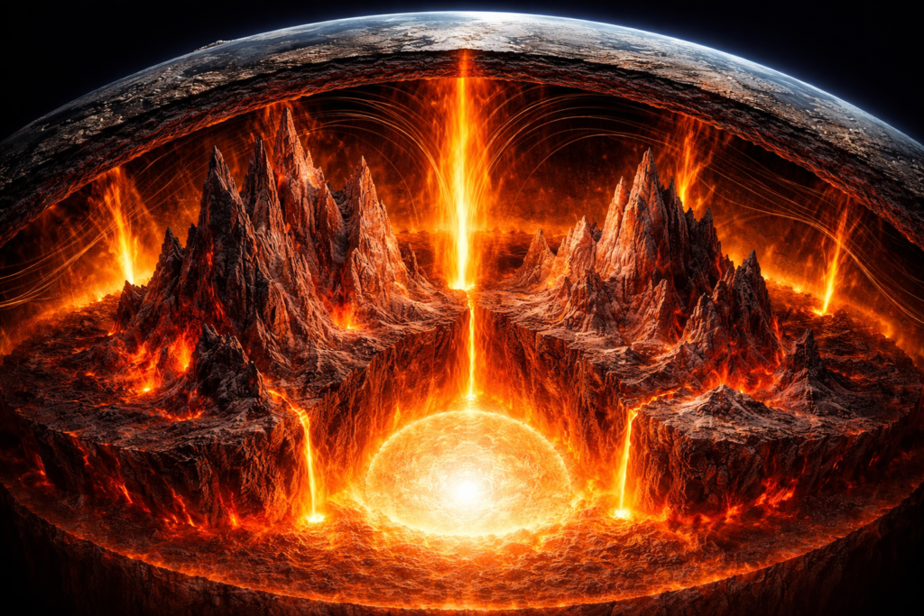
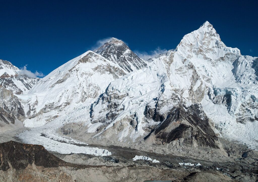
1. Deep mantle peaks stretch far beyond Everest’s height.
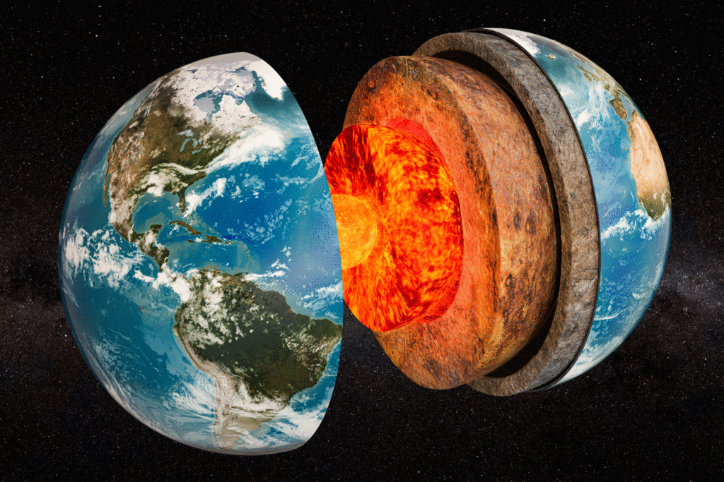
As seismic maps sharpened, researchers traced massive structures deep in the mantle within regions called Large Low Shear Velocity Provinces, or LLSVPs. These are vast zones near the core where seismic waves slow, signaling hotter, denser material. Inside them, scientists identified towering peaks rising from the depths, some exceeding 100 times Everest’s height, based on work led by Dr. Sanne Cottaar of the University of Cambridge. Wave speeds dropped along steep interior walls, revealing hidden ridges and plateaus anchored at the core mantle boundary.
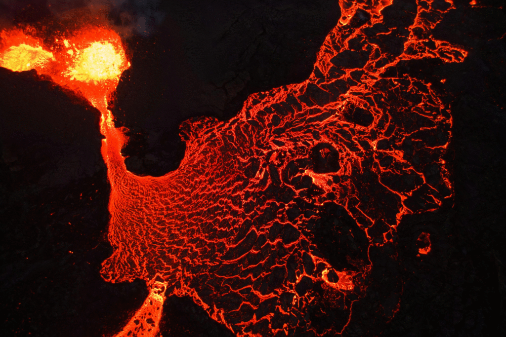
Further imaging showed these formations redirect heat rising from Earth’s core. Their height channels thermal energy into focused pathways that feed volcanic hotspots at the surface. Their rugged upper edges appear to shape where mantle plumes begin, linking deep structures to distant eruptions. Instead of a smooth interior, Earth reveals a jagged, dynamic landscape.
2. Seismic waves revealed immense structures under the Pacific.
Unusual delays in seismic arrivals beneath the Pacific first hinted at dense structures interrupting wave paths. These distortions repeated across global earthquake datasets and became clearer once Dr. Edward Garnero and his team at Arizona State University compared wave patterns from distant stations. Dense material rose for hundreds of miles near the core mantle boundary, its boundaries surprisingly abrupt in a region long assumed to be smooth.
The repeated signatures left little room for doubt. Every major quake added new detail, reinforcing the presence of enormous interior walls and elevated regions that altered the direction and speed of seismic waves. These deep formations changed how heat accumulated and moved, guiding thermal pathways that influenced where mantle plumes anchored. What once looked uniform now resembled a continent-sized structure embedded in the deep Earth.
3. A vast hidden zone emerged under the central Pacific.
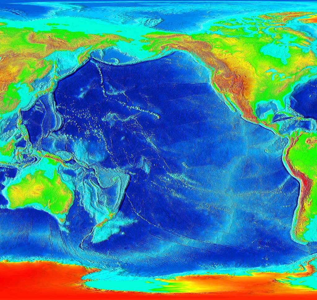
Another region under the central Pacific revealed wave speeds so slow that it stood out immediately. Seismic signatures passing through this area pointed to an unusually thick and dense zone, a feature highlighted in research led by Dr. Jessica Irving of the University of Bristol, as reported by Nature Geoscience. This formation rose like a massive internal plateau within the larger LLSVP, with sharply defined transitions and internal ridges that extended upward for great distances.
Earthquakes from around the world traced its perimeter again and again, confirming its striking irregularity. The heat distribution inside the region suggested it could act as a launch point for the roots of deep mantle plumes. As imaging improved, its internal structure appeared increasingly intricate, shaping mantle flow in ways early models could not account for.
4. The deep giants help guide mantle plumes upward.
When plume roots were mapped onto seismic images, a clear pattern emerged. Many plumes originated along the edges of the deep formations, where sharp temperature and density contrasts allowed heat to rise more easily. These boundaries acted as natural channels that focused thermal energy upward, helping sustain hotspots such as those beneath Hawaii and Réunion.
Seismic wave distortions above these regions supported the idea. The plumes followed paths consistent with the unseen terrain below, often tracking along deep ridges or rising through gaps between dense structures. These patterns suggested that plume stability and longevity were tied directly to the hidden geometry of the LLSVPs.
5. Chemical differences hint at ancient Earth material.
Some parts of these deep structures produced seismic responses that differed distinctly from typical mantle material. Their density and wave behavior implied the presence of chemically unique components that may have originated in Earth’s earliest crust. Over billions of years, descending slabs could have delivered ancient material into the deep mantle, where immense pressure preserved it in isolated pockets.
These chemically distinct regions affected how waves moved through them, offering rare clues about the planet’s earliest composition. If confirmed, they may represent some of the oldest intact material left on Earth. Their presence also added complexity to the LLSVPs, suggesting that these vast regions might contain layered histories.
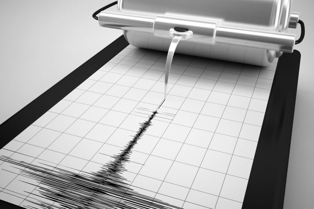
6. Earthquakes trace the hidden contours like moving lights.
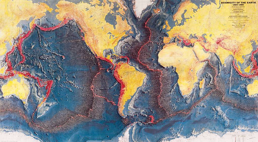
Each earthquake sends energy through the planet that reveals another piece of the deep landscape. When seismic waves strike dense walls or elevated structures, their speeds shift abruptly. By comparing the arrival times of these waves across stations around the world, researchers map the deep mantle’s interior contours with increasing precision.
Distant earthquakes proved especially valuable, traveling long arcs that cross multiple structures before reaching seismic stations. Over time, thousands of signals accumulated into a global dataset that made hidden peaks, valleys and plateaus unmistakable. The combined effect turned Earth’s seismic network into a dynamic imaging system capable of revealing features never directly observed.
7. Subtle internal changes suggest slow movement over time.
Although buried beneath immense pressure, the deep formations showed slight shifts in density that hinted at slow internal movement. Some boundaries appeared to deform or migrate over millions of years, responding to the broader flow of the mantle. These motions, though subtle, shaped how heat moved through the deep interior.
Long term monitoring revealed that wave arrivals shifted in ways consistent with the gradual reorganization of material near the core mantle boundary. If these structures do migrate, they could influence long term changes in surface volcanism and tectonic activity. Their slow evolution introduced a dynamic element to regions once assumed to be stable.
8. The sharp edges create zones of concentrated heat.
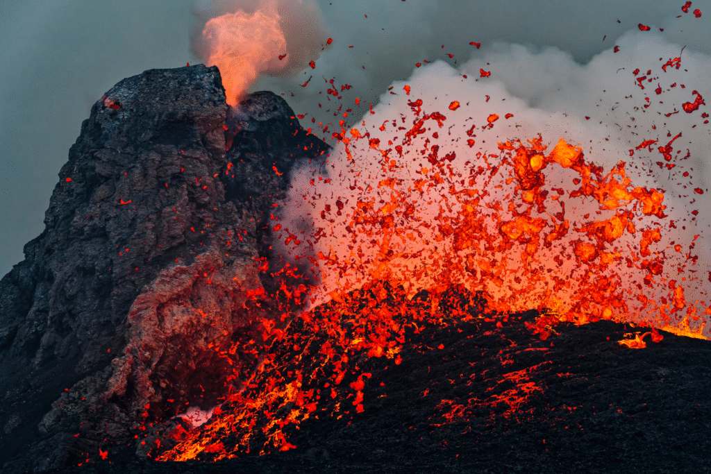
Where the dense formations meet surrounding mantle, significant temperature contrasts develop. Heat rising from the core pools along these boundaries before finding pathways upward. These concentrated heat zones encourage the formation of focused plumes that rise through the mantle and feed persistent volcanic features at the surface.
Wave speed reductions near these boundaries reveal the effects of extreme heating. The edges act like deep interior ridgelines that direct thermal flow in specific directions. This guided movement helps explain why some volcanic regions remain active for extraordinarily long periods while others fade.
9. Their presence disrupts traditional models of mantle circulation.
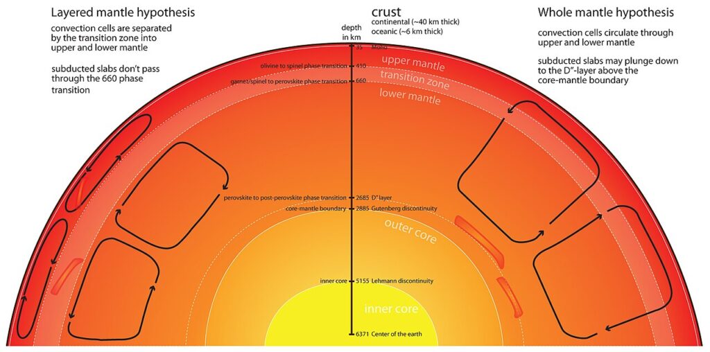
Early mantle models assumed large, smooth convection cells with predictable flow patterns. The discovery of immense interior structures complicates this view. These formations interrupt and redirect flow, fragmenting broad convection loops into smaller, more irregular systems.
This reconfigured circulation aligns more closely with observed variations in tectonic activity, hotspot locations and heat flow around the world. The deep structures act as massive internal barriers and guides, shaping the pathways through which material and energy travel inside the planet.
10. These deep giants redefine how we understand Earth.
The scale, complexity and influence of the LLSVPs and their towering internal peaks challenge long held assumptions about Earth’s interior. Their heights, which can exceed Everest more than one hundredfold, reshape how scientists think about mantle behavior, plume stability and volcanic persistence. Processes at the surface may be tied more directly to these deep formations than once believed.
As seismic imaging continues to advance, the hidden landscape grows sharper with every dataset. The emerging view suggests that Earth’s most colossal mountains lie buried in permanent darkness, rising through the mantle to heights that no surface feature can rival.