
A quiet ocean shift carries dangerous consequences.
A strange tension has been building along the Atlantic seaboard as researchers watch a subtle but stubborn change unfold beneath the surface. Warmth is pooling in places that used to stay cooler, and the currents that usually carry that heat northward are showing signs of hesitation. The mood inside coastal labs from Miami all the way to a small scientific village at the edge of Cape Cod has shifted. Instruments keep climbing past comfortable limits, and every new reading feels like a warning written in saltwater, rising faster than anyone expected.
1. Rapid coastal rise accelerates as circulation weakens.

Warm water has been nudging against the Southeast coast with unusual persistence, and researchers now suspect the slowdown of a major Atlantic circulation pattern is part of the reason. According to NOAA, tide gauges from Charleston to Port Canaveral have spiked at rates two to three times the twentieth century average. That kind of acceleration usually unfolds over decades, not a handful of years, which is why scientists are watching these curves so closely.
Communities along low elevation stretches of Florida have begun adjusting emergency plans even during quiet weather. The rising baseline means ordinary afternoon tides now reach into streets that rarely flooded a decade ago. It feels subtle while standing on the shoreline, but the pattern is unmistakable from a distance, and the steady creep has started to influence building codes, stormwater decisions and homeowner insurance in counties that once assumed they had time to prepare.
2. Heat gathers along the East Coast as currents redistribute.

Oceanographers expected seasonal warming near the Gulf Stream boundary, though what they are recording now sits far outside those rhythms. Instruments off Cape Hatteras show heat pooling on the land facing side of the current, which suggests a shift in how the Atlantic is redistributing energy. As reported by NASA Earth Observatory, the warm anomaly has been persistent rather than seasonal, a detail that has pushed researchers to reexamine long held assumptions.
This regrouping of heat is not just about temperature. Warm water expands, and that expansion stacks directly into regional sea level. Towns in the Mid Atlantic have noticed higher water lines even on windless days. It makes nuisance flooding linger longer, which gradually erodes marsh barriers, and those marshes once absorbed storm surge for places like Norfolk. The worry now is whether the shifting heat will settle in for years rather than months.
3. Northern shifts signal deeper changes in Atlantic movement.
Farther north, the signals have been harder to ignore. Buoys south of Newfoundland have detected unusual salinity layers that suggest mixing is weakening. That mixing is part of the greater Atlantic overturning that keeps heat moving across the basin. Some of the early evidence, as stated by the Met Office, appears to confirm an ongoing trend toward reduced strength in these overturning motions, a change that influences everything from sea level to storm tracks.
New England has already seen record high ocean temperatures that forced lobster fleets to operate farther offshore. When coastal water warms this quickly, it raises the local sea surface height and reshapes weather patterns over the Northeast corridor. Even a slight suppression of the northbound current can make local waters sit higher along the coastline for extended periods. The shift feels technical in data sets yet plays out in very human ways along the waterfront.
4. Gulf Stream wiggles now push water toward vulnerable shores.
Researchers along the Outer Banks have studied how small changes in the Gulf Stream’s path can tilt sea level along the coast. A modest westward drift can create a temporary pileup of water along North Carolina, and these wiggles have become more frequent. The difference might be inches on a gauge, though inches quickly become costly for communities already elevating homes.
Some residents now track ocean forecasts the way others track weather apps. The mood changes when the current hugs the coast a little too long. It raises the base level before storms even form, which means a nor’easter or a tropical system arrives with an extra push. That added height has started to reshape flood mapping in counties that once relied on historical averages that no longer hold steady.
5. Thermal expansion increases as deeper waters warm unusually fast.

Researchers used to assume deep Atlantic layers changed slowly, though newer sensors are showing warmth slipping deeper than expected. When deeper layers expand, they lift the entire surface subtly but steadily. This rise is slow motion by nature, yet it adds to every storm surge hitting the Eastern Seaboard.
Fishermen in Maine have commented on how the water feels different even in early spring. Those impressions match the growing concern that deeper warming will continue, which makes the long term rise harder to control. The shift in heat distribution has effectively become another tide pushing against coastal planning.
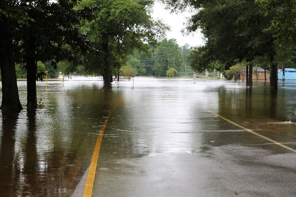
6. Storm surge heights grow because the starting point creeps upward.
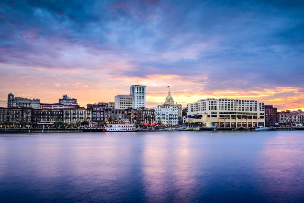
Surge models for cities like Savannah once assumed a lower baseline sea level. Now emergency planners must add a few extra inches before they even begin calculations. The change seems small until a storm arrives, because a higher starting point amplifies every wave.
Local officials have begun revising flood gates and pump schedules to match the faster rise. Even inland neighborhoods feel the effect when rivers back up during heavy rain. The conversation has shifted from if it will matter to how quickly it will reshape daily life.
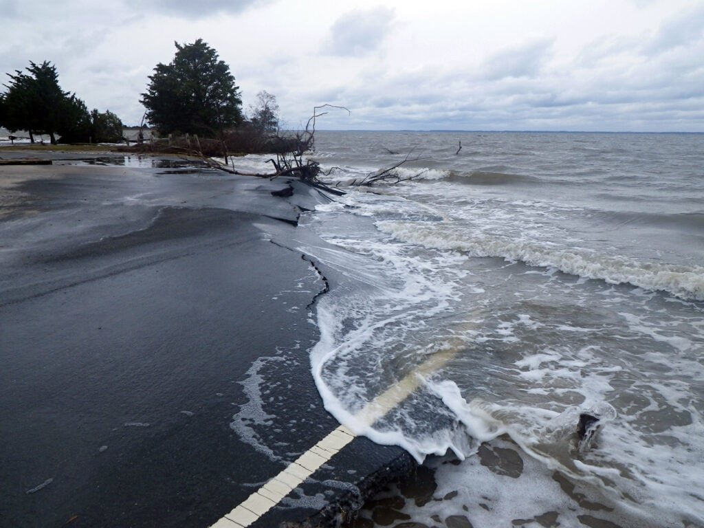
7. Barrier islands lose resilience as currents feed higher water lines.
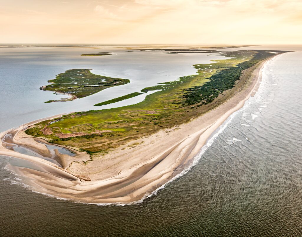
Communities along the Carolinas depend on fragile barrier islands to absorb incoming energy. Those islands flood more often now, which weakens dunes and pushes maintenance crews to rebuild walkways after every high tide cycle.
The higher water line reaches roots that once remained dry, and vegetation loss means the sand moves more easily. These islands were always dynamic, though the faster rise has accelerated their changes. People who grew up there say the land seems to breathe differently, as if each tide reaches a little farther than memory suggests.
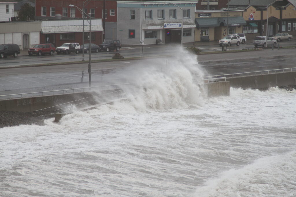
8. Northeastern harbors face record high tides even without storms.
Portland, Boston and Providence have documented more frequent high tide flooding events. These are clear sky days that still put seawater on sidewalks. The persistent rise has made tidal calendars feel outdated.
Shop owners have adapted by installing removable flood boards at their doors during certain weeks of the month. The rhythm of commerce adjusts along with the water. It is the kind of transformation that happens slowly until one day it becomes part of daily routine without anyone remembering when it changed.
9. Louisiana and Texas shoulder compounding rise from ocean shifts.
Although the Gulf is not directly governed by Atlantic circulation the same way the East Coast is, the basin responds to broader ocean heat changes. A warmer Atlantic adds energy to connected systems, which influences Gulf sea level over time.
Coastal parishes in Louisiana now monitor both local subsidence and broader ocean trends because together they raise water levels quickly. Texas ports have expanded surge walls after noticing higher water even during calm seasons, a sign that the background ocean height is drifting upward.
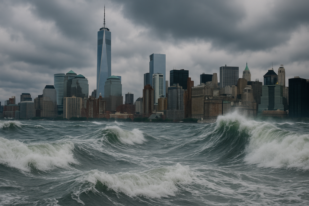
10. Cities begin mapping futures shaped by accelerating rise.
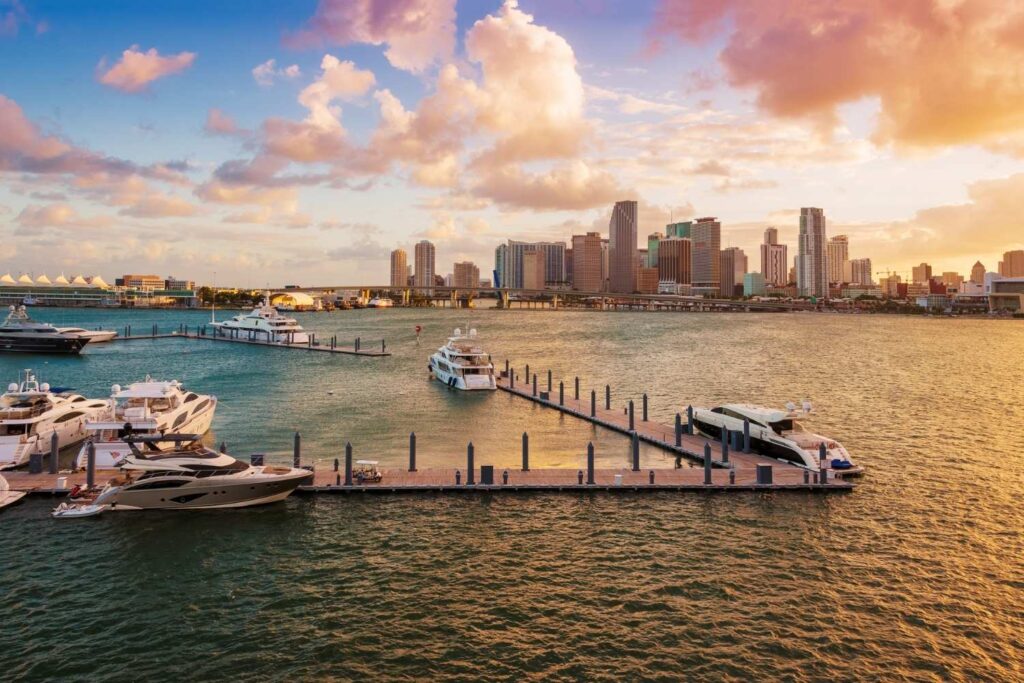
Urban planners in Miami, Charleston and New York have begun referencing new sea level projections that assume continued Atlantic heat redistribution. These projections shape infrastructure choices, from elevated roadways to redesigned drainage zones.
Residents sense the shifting tone. It feels less like speculation and more like preparation. The ocean does not announce its intentions. It simply keeps rising in ways that echo the quiet changes happening far offshore, where the Atlantic circulation is rearranging its energy path and redrawing the future shape of the coast.